


gottolovethisweather
-
Posts
7,850 -
Joined
-
Last visited
Content Type
Forums
Blogs
Gallery
Events
Learn About Weather and Meteorology
Community guides
Posts posted by gottolovethisweather
-
-
On 12/01/2017 at 12:32, gottolovethisweather said:
A cold ole spell is ahead of us guys n gals; those homebound don't forget to feed and water the garden birds and try to assist other wildlife where you possibly can, as it is not all about us and our welfare when cold weather hits.

Wow, a week since I posted in here and back then my eyes were fixed firmly on watching a few flakes fall from the dull looking skies, ended up with a slight dusting which was very welcome but nothing terribly exciting for us snow lovers. Before then, some six days beforehand, my analysis of the ECM had hinted at a watch period from the 12th through to the 16th January, which in reality became cut short by around about a day. Now, having studied the ECM outputs in the meanwhile, I feel we are looking at a mainly cold and dry period down South in particular right through to about the 26th January, of that we can be reasonably sure. An oddly HP dominated settled winter we have had and continue to have, so anyone looking for wintry stuff might have to back off from the models for another week yet until any likely changes come into realistic timeframes. Personally, I don't mind these conditions at least where the winter sunshine breaks through, and sparkly crisp frosts persist throughout in some parts of the local countryside and even in the shaded back garden. Another cold day today with Air Temperatures struggling below 3c as a Maximum in Newbury and the highest Temperatures not breaching 6c over the past few days. Expect more of the same for now. My comments above concerning the wildlife etc. still applies so please think of them as, and when you're able to, despite this being chilly at home, of course, it is nothing like compared to most of Europe right now where it is brutally cold in places.
-
 3
3
-
-
6 minutes ago, Polar Bear said:
Right.... ok need to keep an eye - happy if it is slushy I can handle that (although BMW is rear wheel drive ha ha) - the 5pm MET office prediction then was bang on!
Park the BM and get a lift from someone in a 4x4, another ouch.
-
1
-
-
19 minutes ago, gottolovethisweather said:
Readily turning to wet snow now, down to 1.7c AT and I guess there is another hour or two of precipitation to come for those in central locations too. Will be a dodgy commute later for a great number of people, please stay safe one and all.
Settling on all surfaces now, AT not far from freezing level by the rush hour, ouch. Still some life in this depression yet and I would expect a fair amount of snow over parts of the SE over the coming few hours.
-
1
-
-
12 minutes ago, Joneseye said:
Yep and the precip is still moderate with rapidly dropping temperatures
Readily turning to wet snow now, down to 1.7c AT and I guess there is another hour or two of precipitation to come for those in central locations too. Will be a dodgy commute later for a great number of people, please stay safe one and all.
-
1
-
-
15 minutes ago, gottolovethisweather said:
Being further East than most in here, I like the sound of that, Singularity. Understandably, there is a certain level of trepidation in here with regards, snow predictions but I'd say the precipitation is clearing SE more slowly than the latest media forecasts indicate, increasing the window of opportunity for many more of us, especially those with elevation on their side. 3.4c and falling plus a falling rapidly barometer trend according to my Davis.
Now sleet In Newbury. 2.8c AT, 2c DP.
-
2
-
-
6 minutes ago, Singularity said:
For CS England the complications arise as the developing LP backs the flow ahead of it and then the broad scale NW flow runs into it - the convergence should enhance the convection along a line drawn SW-NE and if that's heavy enough it could lower the freezing level sufficiently for a bit of snow.
Being further East than most in here, I like the sound of that, Singularity. Understandably, there is a certain level of trepidation in here with regards, snow predictions but I'd say the precipitation is clearing SE more slowly than the latest media forecasts indicate, increasing the window of opportunity for many more of us, especially those with elevation on their side. 3.4c and falling plus a falling rapidly barometer trend according to my Davis.
-
2
-
-
3.9c AT, 3c DP. Barely an hour ago it was 5.4c, I'd suggest the wind has shifted but can't confirm this as my anemometer is knackered.
-
1
-
-
On 06/01/2017 at 19:53, gottolovethisweather said:
Hello all, I stated the above when the first round of snow-producing deep cold 850s showed up in the various outputs some seven days ago, the rest is history as they say and you know where the deep cold went, into Central Europe or stay bottled up due North of us. So, in order to NOT pee on anybody's expectations here,I would say currently the next wintry interlude provides us with a slim but reasonable 60/40 percent chance of coming off, given that it is set to begin by D5/D6 (Wednesday 11th/Thursday 12th January). How long will it last? Who will see those beautiful white crystals? Will it settle in lowland England (what a miracle)? All answers to these questions are only likely to be resolved by early next week. Due to my beady little eye watching each of the ECM operational runs roll out this past week and not being distracted by other runs, I can say I am quite confident stating the following given that these dates of interest have shown up repeatedly as timeframes to watch. The first watch date is the 9th January which will likely provide some wintry interest to coldies up North say past Coventry or the Midlands if you like. With my main watch period from 12th January - 16th January being of wider interest to those in England for once, suffice to say Wales, Scotland and Ireland will also likely join in the wintry fun and games IF the broader pattern verifies as currently modelled.
221I know it's been said a great many times before but it just goes to show there is good reason not to follow and jump on each and every run. This post from nigh on a week back, highlighted how it is best not to over-complicate things over when searching for mid to longer-term trends when viewing the models at face value, teleconnections aside, which are outside of my remit (must read more). In fact with the 12th January, today, highlighted by me as a coldie's first date to watch and the subsequent possibility of widespread snow around, I'm well pleased with my original shout/guess, at what I thought might happen by D6 through to D10. So far, so good, it is verifying as broadly suggested. I hope a significant number of us get to see at least a period of snowfall, hoping it settles for some but doesn't cause too much strife for commuters. A cold ole spell is ahead of us guys n gals; those homebound don't forget to feed and water the garden birds and try to assist other wildlife where you possibly can, as it is not all about us and our welfare when cold weather hits.
-
7
-
-
1 hour ago, seabreeze86 said:
The consistency from the ECM is astounding run after run with only slight differences and more importantly bringing the easterly at the same time and not delaying it.
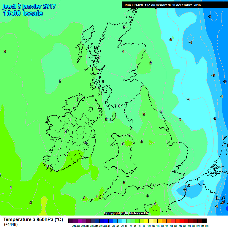
144hrs looking primed
168hrs is epic
Yes, the model you CAN trust, watch and compare 0z with 0z and 12z with 12z and stick to out to D7 and yes, the ECM delivers forecast expectations time and time again. My expectations upon viewing this evening's operational run is a pretty darn cold wintry mix, slowly giving way to further settled conditions in around five days time. And just outside of FI although with a 50:50 chance of coming off right now, is this anticipated Easterly from D8 to D10. Watch this space! A fascinating spell of wintry Synoptics is about to hit our shores.
-
6
-
-
1 hour ago, Frosty. said:
Being a snow starved coldie, I'm happy with the Ecm 12z so far!
.
bring on the Arctic!
Yep, best charts of the winter within reliable timeframe too, so clearly NOT a fantasy this time. Could all change yet though even at t+9,600 minute (D4) timescales as that is a lot of minutes we must count down before we get there. 80/20 percent confidence though on a decent deep cold snap from Wednesday through Friday at least.
-
6
-
-
52 minutes ago, January Snowstorm said:
At 168hrs it's game over for cold spell as milder air moves over the top.
The ecm is exactly what the Meto are predicting......Cold spell followed by milder air
Mention of the word "milder" equals a like from Summer Sun and no one else, lol. Sorry Gavin, just a trend I've noticed.
@January Snowstorm If one ECM t+14,400 minutes chart in isolation is to taken at face value then you are somewhat correct. However, any lying snow having fallen prior to that chart from say t+9,600-t+14,00 minutes (Wednesday through early Friday) would likely hang around under the HP cell influence. HP domination is Gavin's favourite weather as most will know and I personally don't mind it in winter either, lol, so perhaps that was what the like was for. Onwards.
-
5
-
-
40 minutes ago, gottolovethisweather said:
What's the most solid model run of the lot telling us right now, the ECM 12z.?
It's saying COME TO DADDY. Can these verify? only at D5 too, oh my.
Cheers, I'll drink to that,
-
9
-
-
5 minutes ago, Timbo said:
please take note
possible tidal surge on Thursday / Friday, the low pressure in the North sea will push the surge South coinciding with very high tides.
If this happens i feel Norfolk, Suffolk could be hit quiet bad.
As with the snow predictions and even the depth of cold predicted by some in here, the models will be off at t+10,000 minutes which are the timescales people are discussing. I say relax, embrace the opportunities that look like being thrown upon us, could yet be a fascinating end to the next working week, with gales, rain, sleet, snow and hail showers and of course drier interludes ALL in the mix. What's the most solid model run of the lot telling us right now, the ECM 12z.?
-
4
-
-
20 hours ago, gottolovethisweather said:
The first watch date is the 9th January which will likely provide some wintry interest to coldies up North say past Coventry or the Midlands if you like. With my main watch period from 12th January - 16th January being of wider interest to those in England for once, suffice to say Wales, Scotland and Ireland will also likely join in the wintry fun and games IF the broader pattern verifies as currently modelled.
As I stated this yesterday, 20 hours on we might still (despite this being my unfavoured wobbly weekend runs) be bang on course for a decent snap of cold for a day or two at least?
-
3
-
-
18 minutes ago, Kieran said:
Snow again shown for Thursday. I wonder if it will be as widespread as the 12z GFS is suggesting:
Oh I certainly hope the GFS is onto something, and if the UKMO and ECM follow suit, D5 could be where all the wintry fun and games begin. Casting aside the transient and temporary accumulations likelihood for now, things are the best they've looked for a long time in England, let's say.
-
5
-
-
On 31/12/2016 at 17:26, gottolovethisweather said:
The thing is Nick; things ARE going to plan up to D6 or thereabouts, but the -18 850s aren't looking likely to verify at D10 or whichever range they were tempting us which is NO SURPRISE to me. Sorry if I offend, not digging at you but I'm digging at those who got caught up in the hype. This is not to say that cold to very cold air won't reappear in the outputs, but when such conditions are within D5 range I'll join in the celebration, but only then will I do so.
Hello all, I stated the above when the first round of snow-producing deep cold 850s showed up in the various outputs some seven days ago, the rest is history as they say and you know where the deep cold went, into Central Europe or stay bottled up due North of us. So, in order to NOT pee on anybody's expectations here, I would say currently the next wintry interlude provides us with a slim but reasonable 60/40 percent chance of coming off, given that it is set to begin by D5/D6 (Wednesday 11th/Thursday 12th January). How long will it last? Who will see those beautiful white crystals? Will it settle in lowland England (what a miracle)? All answers to these questions are only likely to be resolved by early next week. Due to my beady little eye watching each of the ECM operational runs roll out this past week and not being distracted by other runs, I can say I am quite confident stating the following given that these dates of interest have shown up repeatedly as timeframes to watch. The first watch date is the 9th January which will likely provide some wintry interest to coldies up North say past Coventry or the Midlands if you like. With my main watch period from 12th January - 16th January being of wider interest to those in England for once, suffice to say Wales, Scotland and Ireland will also likely join in the wintry fun and games IF the broader pattern verifies as currently modelled.
-
6
-
-
37 minutes ago, nick sussex said:
Very frustrating output so far this evening. In typical model fashion the UKMO which was the one previous output no one wanted to verify is now better for cold than the GFS. And we get the cold closer to the east earlier but still not close enough.
1The thing is Nick; things ARE going to plan up to D6 or thereabouts, but the -18 850s aren't looking likely to verify at D10 or whichever range they were tempting us which is NO SURPRISE to me. Sorry if I offend, not digging at you but I'm digging at those who got caught up in the hype. This is not to say that cold to very cold air won't reappear in the outputs, but when such conditions are within D5 range I'll join in the celebration, but only then will I do so.
Happy New Year one and all.
-
4
-
-
16 minutes ago, Weathizard said:
Unfortunately the 12z ENS are a further move away from any cold outcome - pretty abysmal at day 7 being honest, ECM will be crucial this evening.
Yes, moisture-laden Southwesterlies bringing endless above average temperatures by day and night and destructive gales for farming, the natural world and humans alike is something I don't want to witness. No, wait, that was 2015 and um, 2014 and 2013 or whenever. Granted, it is not the ideal bitter cold snowy (yes some snow is to be expected for a few within 24 hours) weather situation but it isn't HELL ON EARTH.
-
4
-
-
11 minutes ago, knocker said:
Although model rainfall statistics are a million miles away from being reliable the ten day totals do give an idea of the continued high pressure influence with most areas, apart from the far north west, remaining very dry.
According to my weather station, it detected only 17mm or so during the whole of December 2016, so that's around about 20 percent of expected precipitation totals. January bar a few wintry interludes, to begin with, is set to follow a similar theme, at least for the first week.
-
20 minutes ago, Summer Sun said:
ECM going for south westerlies at t144
Which means moist-laden weather fronts drenching us all, er no. Frosty and dry and potentially mild but still cold by night where skies clear. Southwesterlies aren't welcomed by many in here and welcomed by a tiny majority at that, but to be clear, the Atlantic is NOT breaking through and it WILL remain largely dry IF these charts verify.
Don't all scream at once. It's not as dreadful as it sounds yet it could be better for those wanting cold wintry weather.
Nothing wrong with the posting in general as it's highlighting what the models suggest but Summer Sun does miss a trick in being a bit more descriptive.
EDIT: Summer Sun's update to his post above should now read winds backed towards the west by the 6th (one day later) and if I were to preempt the ECM here, backed NW to NE by the 8th, lol.
-
3
-
-
Based on my analyses of the various ensembles I've seen posted up on here, I'd suggest the period from January 1st (albeit later in the day down south) through January 3rd will be cold/very cold, when compared to the norm. During this period, there are chances of temporary snow accumulations almost anywhere, especially in the prone areas exposed to the N and NE winds. By the 4th January it will warm up once again (still frosty by night where cloud breaks) as a period of HP cell domination should return, so overall a dry picture by then. Come the second week of January; it is possible that polar air streams will again envelop the UK, but as this is still some time away, I'll revisit that particular prediction early next week.
EDIT: If tonight's ECM is correct, the window for wintry precipitation will be short-lived, from 1st through to the 2nd only. UKMO Fax charts outputs and local media forecasts will provide best guidance on this aspect.
-
5
-
-
19 minutes ago, chionomaniac said:
If I could programme a snow and cold lovers run into the GFS then the FI of the 06Z would be pretty much it for a perfect scenario. Pity it's FI really.
Welcome back and yes indeedy Chiono. It's only FI for another 4-5 days, and if such charts remain in the outputs by then, even I might start RAMPING.
Cold (Maxes 4-6c below average) now, a briefly milder blip (Maxes near average) by the weekend. Beyond this into the first week of January, a most intriguing synoptic pattern with cold/mild air battle going on during the best part of the week. By next weekend (D9/D10), we all could be plunged into the freezer with deep cold around, with a high probability of snow around and potentially damaging frosts. -
5
-
-
Page 242 ten posts of one-liners, barely anything model-related, PM function not working? See you in the New Year.
-
4
-
-
- Popular Post
- Popular Post
This forum always seems to read; it's on, it's off, it's on, it's off again in the hunt for Synoptics the vast majority want in here, cold. The clue is in the timescales involved, as to whether people perceive an individual run to be a BOOM run or an epic FAIL. For crying out loud, oops. Cold air (Maxes 2-3c below average) has arrived, thick fog and frost are set to persist during daylight hours over the next 2-3 days for an unlucky (lucky?) few. Post next weekend, ever colder air (Maxes and Minimums several degrees below average) could bring some wintriness to some parts. The New Year period itself may NOT be in the bag yet, but with a mid-Atlantic blocking high positioned due NW/NNW of our shores, an albeit brief Northerly/Northeasterly flow is a decent outside possibility at such a range. In fact, they are dream-like winter wonderland charts given what we could have at D5/D6.Whether the Northerly/NE'rly flow lasts or not who knows, but the New Year period albeit temporarily milder, to begin with, will highly likely kick off 2017 on a HAPPY note for coldies, with wintry weather patterns never far away. More than enough reasons to be cheerful! Just don't go rocking the boat before it's even left the port, my friends.
-
24


 Cheers, I'll drink to that,


 Cold (Maxes 4-6c below average) now, a briefly milder blip (Maxes near average) by the weekend. Beyond this into the first week of January, a most intriguing synoptic pattern with cold/mild air battle going on during the best part of the week. By next weekend (D9/D10), we all could be plunged into the freezer with deep cold around, with a high probability of snow around and potentially damaging frosts.

Model output discussion 8th Feb - Cold for now, but then what?
in Forecast Model Discussion
Posted · Edited by gottolovethisweather
Some corking good analyses in here from the usual suspects, so I need not add much more other than to say........... "Baby, it's cold outside" Temperatures are set to progressively fall by day and night over the next four to five days. Afterwards, you have to expect some milder and perhaps unsettled weather to attempt to penetrate our shores. However, I think it's quite likely that the last week of February will end on a bitter note as well. The trend of Easterlies in February has once again bore fruit, and with that, some snow is always likely, especially for parts due North and East and at elevation. Will I receive anything like a snow-fest in central Southern England, perhaps not but the local hills will almost certainly receive a dusting. Will you, my friends, acquire some magical white ice crystals as well? Watch the local forecasts and follow your local threads to find out whether the possibilities are there.
For fellow cold-loving fanatics, take care and have fun whilst the cold spell is in attendance. It cannot stay that way forever but the mildies might have a battle on their hands. I'd suggest we don't look beyond D5 in any great detail just yet.