


Snowmad79
-
Posts
1,102 -
Joined
-
Last visited
Content Type
Forums
Blogs
Gallery
Events
Learn About Weather and Meteorology
Community guides
Posts posted by Snowmad79
-
-
Well @ 297m We've had nothing but none-stop rain since around 7pm! and it festering freezing cold out there. Gutted so far, thought I'd have seen something sleety by now

-
Well there has been a lot of Heavy rain so far here, though it's starting to turn increasingly wintry...
-
 1
1
-
-
Fergie did add that Shannon is on holiday till after Christmas. So it is probable that there won't be a pattern change in the medium term, confirmed by recent FI output.
Nothing is confirmed until it verifies! To be honest, everyone seems so hung up looking for the Scandi block they are missing the bigger picture and that is frequent incursions of PM airmass via the North and West. Even if we continued in the current pattern it will be a good thing for many and better than last year.
Wind at times ? Yes, Wet at times Yes ? Snow showers for many ? Yes. Obviously the models do not currently show a severe and prolonged cold blast via blocking but it is not the be all and end all. Some of us have already had snow but we should not forget that changes to severe cold can often be abrupt.
-
9
-
-
Well, already had our first snow shower today in the Oldham East area. We are certainly off to a better start than last year!. Have to say, I reckon there will be a lot more to come off the North Westerlies progged on the models and often Forecasts show nothing for my area but experience tells me those at Elevation towards the pennines will see Snowy weather.
Reading the model thread often looks gloomy because most people are from the South and East looking for the beast so not much gets mentioned about NW wintery weather.
Personally, I'm more than happy to see charts like this:
Some of us will get a right pasting of white stuff
-
4
-
-
vortex sent packing
Yeah a trend I've noticed also is for the vortex to take another hit and weaken followed by a relocation of the main lobe back over to the Russian side of the arctic. Imo I think it's going to be a case of waiting for this to happen before there is any real chance of a deep cold pattern developing.
-
2
-
-
ECM op is a synoptic outlier. That's to say that it's outside the spread of its ensembles in respect of the depression (re low thickness and it's too far west). There is a spread that takes this depression through Denmark and then drifts it east from there.
don't expect to see that ECM op run again as close to the uk with the depression.
How can you call that an outlier with all the support it has from a decent cluster of members ?
I haven't followed the chats all that much and have just followed the postings in this thread.. so I'm a tad confused.
-
1
-
-
Oh give me strength! Either he'll post or he won't. It'd be nice if he does, but hardly the end of the World if he doesn't.
The continued silence just seems like a childish sulk tbh.
Don't be so rude. He is one of the most respected, knowledgeable and interesting posters ever to grace these forums. I mean wasn't Steve the guy who brought things such as the SAI to the attention of all model viewers ? with the intention of using such in a forecast, only for Strat followers to incorporate this into there own forecast and release prior. I'd be peeved off too tbh.
-
6
-
-
Personally I'm a little gutted as I was looking forward to Mr Murr's take on winter despite any similarities with other forecasts. With this forecast cancelled I hope we will see more end of the day analysis from you over in the model thread!
-
1
-
-
Well I'm not sure what the crack is in the model thread and some posts here about this big change in weather and getting something different because here in the Oldham / Manchester area it has been very wet, cool and often windy at times over the past week or so! and I wouldn't exactly call my area "the far north west".
Last Tuesday for example, we had 7 hours of none-stop rain, heavy at times and plenty of rain on and off since. So no, for a lot of people there is no big change other than temps might drop off a little more and a bit more wind. Thus, reading the model thread over the last week as been some what misleading.
-
GFS fails to move the trigger low SE. It just weakens over us before the PV starts to move Eastward.
Looks like the ECM may follow suit with the UKMO, which is pretty awesome looking at 144HR. I can't see the dartboard low at 120hr stalling or sending energy NE this time around.
Here's hoping the energy goes SE and continues to do so.
-
1
-
-
I cant understand for the life of me how that low doesn't go under? What is stopping it? Can anyone explain?
Didn't Steve or someone say the other day that if Lows barrel in from the Atlantic to deep they wont slide SE under the High ? I am sure someone mentioned it.
Anyway, quite a shocking flip from the models today. It seems like one of occasions where a forecasted block with cross model aggreement was never even there to begin with.
-
1
-
-
Oh dear..
Entire pattern further East, might still undercut but the undercutting will take place over the UK rather than to the West/South-West keeping us in the milder Atlantic airmass for considerably longer.
Oh dear indeed. Maybe we should wait for the other model 00z runs before making any assumptions ? The GFS still goes on to show some potential after 108hrs....
-
1
-
-
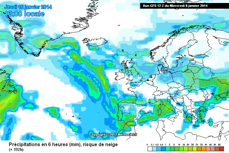
Well I wanted to sit back this year and watch the models whilst reading the posts in this thread but I can't help posting in exitement. Model watching has been painful of late and now we are heading through the new year we are being spoilt!
The GFS 12z is by far the best for decent cold and a snowfest for a hell of a lot of peeps with the snow being driven well inland from the east.
http://modeles.meteociel.fr/modeles/gfs/runs/2014010812/gfs-2-192.png?12
Beautiful, bring it on. Mind you, still time for it go pairshaped yet.
-
Looks like the downward trend of GFS ensembles members for the T850's is starting to gain momentum in the models. Regardless of whether the ops have been outliers the mean was painting the picture of a cold blast barely scraping the -5 mark a few days ago and dropping further yesterday with more members going for -8 to -10 850's.
The ecm looking good again this morning at T168 with the consistent portrayal of a cross polar flow and now with a glimpse of the possibility that we may see some WWA up towards greenland which can only be good for an attempt at a GLH blocking senario. Also looks like the PV is being displaced and not able to set up shop over the greenland area which is good news for my preference of weather.
Hopefully the trend can follow through or upgrade as FI output comes into the reliable and not turn out to be another red herring snowfest.
-
2
-
-
Thank you, this has now been resolved by support and the thread can be close.
Cheers
Craig
-
In laymens terms?
30% chance of sleet to snow 8pm
-
Not far off 300m here and it was sleet to rain to sleet and so on before stopping altogether and now its just grizzly out there. Pathetic sums it up.
-
Hiya peeps, just home from work in Shaw which closed down mid shift due to the snow (YODEL) widely 4-5 inches on the roads alone in Shaw. Got back to Sholver (via the gaffers 4x4) and the depths are 1ft to 4ft... Absolutely amazing finish to this cold blast!
I have to say, what we had overnight is pretty much what I call "classic" winter depths up here! and the drifting is mega! This snap certainly went out with a bang and rates as one of the best winters in a long time.
-
At least we should get one more pasting in the before the telephone boxing Atlantic storms through, quite litterally lol. We will have had 12/13 days of Lying snow and 2 noteable falls. This will then be classed as a far better winter than last year.
Despite what I've said about the models, what they show and what other people have said, I still don't think its over. One thing that has always raised my eyebrow is how Huge spikes in AAM tendacy usually tend to lead some degree of cold pattern by about 3 weeks and we've certainly seen that appear recently!
Mid month (FEB) = game on
-
The GFS out to day 6 is still an overall Westerly dominated pattern and there after it kind of sticks with it previous trend of Heights to our north but to a lesser degree than we have previously seen. More LP systems are fired SE but across the north of the UK, so whilst in the right direction, not really beneficial for Cold and Snow until the very end of the run. A lot of Europe do get plastered with Snow though.
The UKMO showing quite a nasty looking LP straddling the UK next Wednesday with pretty tight isobars over Scotland, Northern England and Ireland. Where it goes after this point is anyones guess.
And for the ECM, again, quite a nasty looking low for Next Wednesday:
Later on and the ECM continues with it's westerly theme, albeit the Azores could ridge over the UK and provide some respite from a predominantly Atlantic based pattern.
Not a very good looking chart at all it has to be said. The final 2 ECM frames aught to come with a health warning for Snow lovers
There is absolutely no route to cold at all on the entire ECM run. Terrible but plenty of time for change -
People complain about others being negative - whenever I try to explain politely why, my posts get removed - I think there is something wrong here.
Because you need to be posting in relation to model output and not justifying so called negativity. Just because someone posts about not seeing any quick return to cold based on model output does not mean they are being negative. A lot of people on here know very well a bad pattern when they see one having spent many years following the models. That said, everyone does need to be "open minded" what ever way output goes.
Try and stick with model output and your posts won't get deleted.
As for the models. Indeed, the ECM now showing signs of what the GFS was initially showing in mega FI with regards to possible height rises to the north. Could well end up similar to the recent setup as Nick S suggests as we head into February. At least we have something colder to watch our for, even if it does turn out to be zonal. No way I am saying it will, especially after the recent palaver.
-
I know this will come to nothing but look at the adjustments on the Output in the so called reliable. The top yesterdays 96hr and today 72hr. I'm probably looking at small detail a little too much in hope but compared with yesterday we now have a developed 990 low rather just a shallow short wave and where as HP bridged across france at 72hr, today LP is digging in more SE/
Slap me and tell me that there is absolutely no chance of LP going SE into France or the med at this stage is there ??
-
Note the numbers on the GWO plot, then associate the composite numbers with them.
Ah yes, much better. Cold it is ha-ha. Thanks!
-
I remain far from convinced that as we approach the middle of February, the upper pattern will look as the GFS FI portrays. Stratospheric temperatures and mean zonal winds have yet to return to normal. The warming and reduced mean zonal winds should continue to impact for most of February, lending support to a disrupted PV, although with uncertainties as to where this will locate. Unfortunately it has recently displaced towards Greenland (+NAO).
The models are bullish with progressing the MJO through phase 7 and into 8, which teleconnects to higher pressure in the mid-atlantic/Greenland region, although perhaps a hint of a western based -NAO about it (higher heights also centred in the Canadian Arctic)
The GWO has also progressed quite rapidly towards phase 5, which the composites show is normally associated with below average UK temperatures.
This, combined with a recent warming event near the Greenland region, would lead me to favour a colder than average first half of February over a milder one (similar to the meto long range forecast).
Interesting to note that the ensembles are starting to trend slightly colder again (long term). Its a trend i would look out for over the coming days.
Re: the GWO temp composites... 4 show Mild, 3 show Cold and 1 Shows average. Odds are in favor of Average or above average 2m temps on those composites unless I'm reading them wrong.


 There is absolutely no route to cold at all on the entire ECM run. Terrible but plenty of time for change


Northwest England - Weather Chat
in Regional
Posted · Edited by Snowmad79
Just started snowing quite heavily up here in Oldham east a bit wet atm but good stuff.
Edit: Might have known it would stop after posting here .....