


swilliam
-
Posts
498 -
Joined
-
Last visited
Content Type
Forums
Blogs
Gallery
Events
Learn About Weather and Meteorology
Community guides
Posts posted by swilliam
-
-
4 minutes ago, swilliam said:
Also looks like Azores high might not link up with a small ridge there now
More importantly everything is a bit further W - including the PV chunk over Canada that keeps gobbling the lows in the W Atlantic which then pulls itself further E
-
1 minute ago, swilliam said:
If you rock over the new frame and old frame on Meteociel you can can see that it is in fact (Currently at 108 old frame at 114)
Also looks like Azores high might not link up with a small ridge there now
-
2 minutes ago, bluearmy said:
You have amazing eyes Karlos!
If you rock over the new frame and old frame on Meteociel you can can see that it is in fact (Currently at 108 old frame at 114)
-
 1
1
-
-
More amplification off the W coast of NA which may hold the low back in the SE from heaading out to sea and interacting with azores high
06Z

12Z
The low is deeper is well so my head further N
-
1
-
-
12 minutes ago, nick sussex said:
No but the initial cold blast was forecast well. We're not even in the cold bit yet! lol The disagreements within T96hrs is not something I ever remember seeing with this type of set up before.
I remember it well - the GFS/UKMO were pretty solid then the ECM churned a couple of runs where the low that came southwards went SW and W based -NAO was shown. This then suddenly changed back again to dropping S.
-
43 minutes ago, bluearmy said:
Sorry but the parallel ops are leading the way on the west based NAO and low upper cold not embedding so strongly beforehand. Due to the Atlantic trough hanging back for too long. the most recent runs less favourable for lasting cold than the previous. However, this is a snapshot in time and must be viewed as such. The ens give us an envelope to work within and the pendulum can just as easily swing back somewhat through the next few op runs. tbh, we know the unreliability of ops post day 6.
this is is a tricky evolution with the polar high and n American trough both of paramount importance in how plays out. We should see the way forward with some reliability over the weekend. if we arrive at the 20th without a decent snow event on low ground somewhere over the UK then it will be a big surprise.
Actually this was shown first on the 18Z GFS on Wednesday. I pointed out during the run that the initial ridge was too far W and thin which could lead to breakdown of the block at was then +240 (see below). This was the evening of the 1st stellar runs so I was then told by several people not to analyse every run, that the means were showing this etc. not to get upset (which I was not doing). All I did was point out what was shown and that we did not want this to become a trend. It confirms to me that no runs should be binned because we do not like what they are showing - just accept that they are one solution (especially beyond t120) which should be accepted as a possible if maybe unlikely outcome. the same applies when it is the other way round with everything showing zonal and then we start to see odd runs and ensemble members showing something different.
Back to the current and as I see it the problem with the initial ridge being to far W and/or thin is that the 2nd surge of WAA does not really happen because of the orientation of the 2nd low in the US. So this low begins to head more NE instead of NW and interacts with the Azores low. This basically comes under the ridge instead going NW into the US. It is pretty much game over then in terms of prolonged cold for us although we my get a big snow event,
However as has been said this phase is currently completely undecided and anything could happen at this stage so we will just have to wait and see. We can look at all the runs (good and bad) and see what the options are. But the main point I feel is that we want the initial ridge bigger and further E and then we want to see the 2nd low to rebuild the ridge rather than going underneath it. Impossible to call at this stage but the trend has certainly been to move more towards the latter this morning but plenty of time for change to the former.
-
3
-
-
9 minutes ago, Mucka said:
GFS 18z ensembles for London(ish) Double digit temps for the 16th? Op run) I think not.
Hope (and expect) that you are right - what a let down that would be.
-
1
-
-
8 minutes ago, Harsh Climate said:
The mean isn't too bad
Yes it is still pretty good but not as good as the 12z. I think this run just shows that it is still possible for it to go wrong.
I am going to stick with the ECM mean and hope it is still like this in the morning.
The GFS threw out a funny run on the 18Z last evening.
-
2
-
-
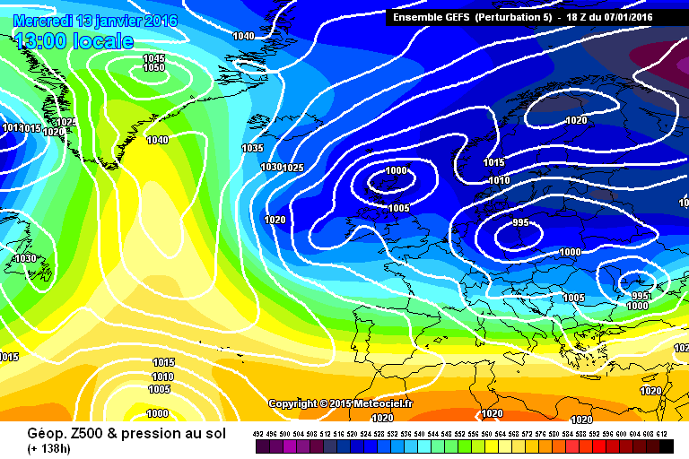
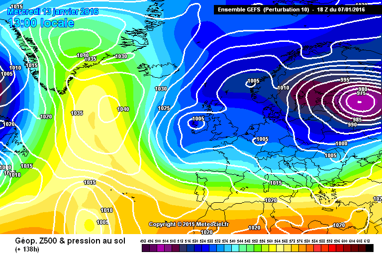
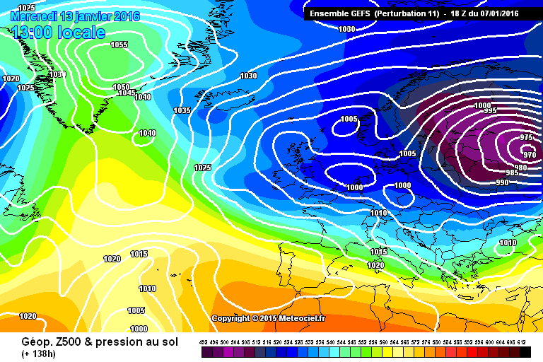
2 minutes ago, Harsh Climate said:
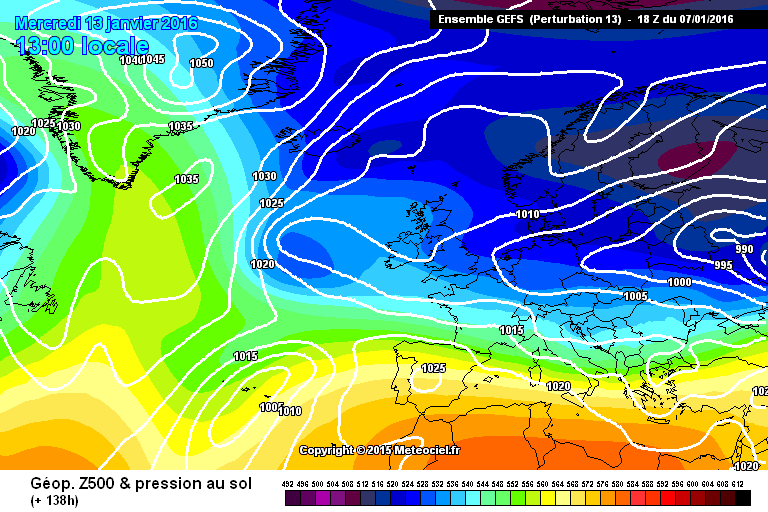
Well looking at the esembles at 138 hours, what a whole host of variations!
Perpetrations 5, 10, 11 and 13 aren't too shabby.
Case closed! Hope I don't have to wheel out that it's a a single run with no support post out again!
Well unfortunately there are quite a few supporting the OP as well.
-
- Popular Post
1 minute ago, radiohead said:18Z GEFS ensemble mean backs the 18Z GFS det at T120. Almost identical.
err - they are the same?
-
12
-
1 minute ago, Daniel Smith said:
Reading the posts in here this morning you'd think the models were showing full on zonality.
Not sure why you have said this. As far as I can see most of the posts have been discussing the position and strength of the block, the depth and longevity of the cold and the usual where will it snow/rain etc.
-
6
-
-
5 minutes ago, feb1991blizzard said:
Yes I noticed that a few frames ago but didn't want to dampen the mood.
Well as I had already put my head above the parapet once I thought I would risk it again.
-
1
-
-
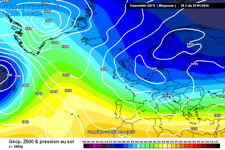
Unfortunately there is quite a bit of support of the Op from the ensemble members - this is reflected in the change in the mean at 192
12Z
18Z
Lets hope this is not a trend even though it gives a few days of cold weather still - as the Meto say - still a question on the longevity
Sorry about the extra picture - seems to be bug if you make a mistake
-
1
-
-
1 minute ago, Mucka said:
ECM London ensembles.
Cold looks pretty much nailed on for 5 days thereafter scatter and a bit of a split.
Who wouldn't of taken those at the end of December?
Quite - looks rock solid till the 14th and then a few rogue members v. unlikely to verify. Then a bigger split around 17/18 which I would imagine is to do whether the ridge gets reinforced by the Azores low sliding up the W side of the ridge and reinforcing the block.
-
9 minutes ago, karlos1983 said:
I'm actually regretting watching the GFS 18z now
Bambi just fell through the ice on that run
Yes - I am regretting making a comment on the difference the run was showing at an early time frame - I will not bother in the future.
-
1
-
-
3 minutes ago, Daniel Smith said:
Yes, let's all get upset over a single operational run. We don't even know if this new "trend" as some are already calling it is supported by it's ensembles.
This is but a single run, one option of many of what could happen come next week. The trend on the 18z continues to be that colder weather will flood across the UK next week. Beyond that has always been in doubt. Can we maybe try being more objective instead of throwing toys out of the pram because our Atlantic high has been to slimming world?
No-one said it was a trend and no-one is getting upset - just commenting on the run. I said it was a problem if it became a trend.
-
1
-
-
1 minute ago, winterof79 said:
ok.I'll leave you to it.Enjoy.
Well I am expecting and hoping that it is not a trend - we will see in the morning.
-
Just now, winterof79 said:
Look at John Holmes's post for trends.
That was based on the 12Z
-
1 minute ago, winterof79 said:
Quite correct do not fall into the trap of over analysing every GFS run.You will end up on Prozac.
Yes that is fine as long as it does not become a trend (i.e we something similar in the morning and then the ensembles show it more)
-
Looks a bit west based this one - hope I am not worrying too much - in any case it will be different tomorrow
-
2
-
-
Just now, ukpaul said:
GEFS for London, a trend beginning to develop.
Yes - if the mean goes below -5 then confidence should rise in the cold shot but of course we would like to see in a shorter timescale.
-
1
-
-
2 minutes ago, feb1991blizzard said:
Yes, another upgrade for those wanted cold on the GEFS, I know respected forecasters on here have told us to look at clusters and ignore means but if the mean is a Greenland high way into the 200's then the cold clusters will look exceptional!!
What was said was that if the mean is showing something close to the climatological average then it is not much use. If it shows a signification deviation from this then it is very useful. This is the case here
-
1
-
-
Shortwave alert around Iceland - holding back the colder air.
-
ECM mean looking pretty good at 240
850s at -6 in the North and -4 in Midlands
-
2
-


Model Output Discussion - 05/01/2016 18z onwards
in Forecast Model Discussion
Posted
Jet in W Atlantic much weaker on this run as the PV stays W
12z
18z