


Chris D
-
Posts
436 -
Joined
-
Last visited
Content Type
Forums
Blogs
Gallery
Events
Learn About Weather and Meteorology
Community guides
Posts posted by Chris D
-
-
4 hours ago, JennyJane1 said:
UK cold snap set to 'extend BEYOND Easter' with 'MULTIPLE Beasts from the East until June'

I suspect that the beast would be so tired by June that he may simply burn in mid air, imposing some effect at ground level as he does so
-
 1
1
-
-
Pretty stark langauage in the Met Office 10 day trend forecast...
https://www.youtube.com/watch?v=sir0p7u7XrQ
-
4
-
-
1 minute ago, Bottled Snow said:
Latest 120 hour fax chart.....notice the warm front in Atlantic west of Ireland facing / heading northwest towards Iceland rather than the normal push eastwards....sure sign of retrogession of cold block...UK and Ireland already in easterly flow ....awaiting infux of very cold uppers and snow from east....stunning output.......night all...
Best chart of any.
-
1
-
-
1 hour ago, Tom Jarvis said:
Paul what if it isn’t actually drunk and giving us some sober runs!!!!!!!
The 18z is always drunk
-
30 minutes ago, Ice Day said:
Top that for a set of short ensembles.......don't bother, it's impossible.
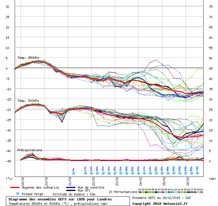
Edit. Note the tiny scatter at day 8
They really are incredible ensembles!
Can I just say I don't post in here very often at all as I'm what is (probably) known as one of these Netweather 'lurkers'
I took one look at this forum tonight after the ECM 12z tonight and thought the end is nigh...and this cold spell might be odds off, gone in the tipper and burnt by the Atlantic. But actually, you look at the fact that the ECM 12z op is a really big outlier - this really just shows how strong the signal is for the block to set up in this way. The GFS 18z is just outrageous and is (in my honest opinion) an extreme solution.
It seems to me, though, all models have got this block sorted and pretty much nailed. The only question is...just exactly HOW much snow??
-
3
-
-
Irma now up to 180mph sustained winds
http://www.nhc.noaa.gov/text/refresh/MIATCPAT1+shtml/051445.shtml?
-
1
-
-
http://www.ssd.noaa.gov/goes/east/catl/h5-loop-rb.html
I cannot tell if it's actually undergoing eyewall replacement or not? Seemed like it weakened slightly so maybe it has. The eye is so small it's tricky to see! NHC were expecting it to take place to be fair.
-
Was not expecting this for Norwich! Couple of cms at least and building quickly!!!
EDIT: REALLY big flakes now too!
-
4
-
-
9 minutes ago, chrisbell-nottheweatherman said:
Dad reports sleety snow west of Norwich, but here, rain.
Can confirm sleety snow in west Norwich
Shockingly!
-
Just now, Let_it_snow said:
Does anyone have any idea on chances of decent snow tonight in Norfolk. Doesnt look great for tonight if you like snow in my area. Please correct me if im wrong!
Well, I'm hoping to maybe see a flake or two in Norwich. Stranger things have happened, but the current forecast is for the heavier stuff to be further south. That is if things go to plan, though, and this appears to be an extremely unpredictable situation.
-
1
-
-
1 minute ago, VillagePlank said:
GFS12z forecasting the position at 6pm to be the same as it is now. Looks to have it's timings a little bit mixed up. I can't believe that by 6pm there will not be falling snow in the SE. Could be wrong, I suppose ....
Well, it is the GFS we're talking about here
-
Just now, Ben Lewis said:
"100 flights cancelled at Heathrow due to snow" source: BBC news.
How embarrassing- other countries must absolutely pi** themselves at us.
Fair enough if we were due some 6 inch blizzard, but it's a 50/50 possibility of a rain to snow event - there isn't even an Amber warning!
The bbc news live reporters at gritting depots are equally cringeworthy!
The UK media irrational fear over a flake of snow is part of the problem here. Uncessecary scare mongering "artic cold to batter U.K." Whilst standing in front of England's green hills... pathetic!
Just when you thought we were maybe getting slightly better with all those colder winters, our long period of mild winters bring us back to a one small snowflake = panic affair. Modern britishness at its best.
-
4
-
-
16 minutes ago, stewfox said:
Congrats
Not seen Ian for ages unless now under a diff name. He was fun to read on the model output
Yes Ian Brown is an absolute Netweather legend in my opinion!
Hoping to see something today. Keeping an open mind re snowfall...
-
I'm a lurker in this particular thread, although I haven't been posting very often recently. However monitoring the models from a tentative distance even I can tell ALL the models have set something up as early as T120 and I am looking forward to how this pans out past this point. I think there is now very high likelihood that some sort of good northerly is on the cards (with a good chance of snow).
How this reloads is another matter but just to remind you about how the past few winters went
-
5
-
-
Bigger flakes now!!!
Dare I say....moderate snow?!?
-
We have snow in central Norwich!
OK began off as hail but now snow yes!!!!
Starting to cover on top!
Edit: well a mixture, on/off snow lol
-
Norwich and suburbs getting dumped on now.....
Kind of soft hail/ice pellets but very heavy
Everywhere white though!!
-
Yes one heck of a rain/hail storm that just passed through Norwich!! Might have heard faint thunder as well but not sure...
-
Oh my, what have I come into here!! nearly 1,000 people reading this thread haha!
Very good runs from the models tonight, and -10c 850s I see, must be a sign of something, and cross model ageement??
Cold spell approaching? Maybe.
-
Just turning now. 1.9°
Mhm this is a good sign for me then! Fingers crossed I see some flakes haha
-
1
-
-
Well, wet through here lol. Not a flake in sight!
-
It's still 20hrs away though and highly volatile and open to correction, could still go 100 miles southwards, extreme uncertainty still over at the Met Office, probably the reason why their warning area covers such a vast space.
Dont even think the precip will reach you mate, hope im wrong and shunts even further north
Aye the uncertainty of this one must defo be stressed - haven't seen this amount of model volatility in a while. As has been said, there could well be rather substantial changes in the intensity & track of the LP yet! May go down to the wire really
-
Well that does look good actually haha. Although I think the temps are too marginal for the snow to be settling for me at sea level especially, temp accum.'s in other areas with any sort of height very likely though.
I just wanna see some snow falling after the abominal winter of last year lol.
-
1
-
-
Well for mwah where I am, I think I expect to see at least some snow (hopefully) but none of it settling from Boxing Day night's event. At the very least, some sleety stuff.
That is providing the thing doesnt move any further south lol. Still nice to see any snow though!
Oh, and Merry Christmas! :w00t:


SE and East Anglia general weather discussion 26/03/2018 onwards
in Regional
Posted