


summer blizzard
-
Posts
18,635 -
Joined
-
Last visited
-
Days Won
9
Content Type
Forums
Blogs
Gallery
Events
Learn About Weather and Meteorology
Community guides
Posts posted by summer blizzard
-
-
04OCT2023: Nino3: 1.9 , Nino3.4: 1.5 , Nino4: 1.2
-
Actually quite lovely in the sun.
-
 2
2
-
-
While it is theoretically possible to sustain a perverse outcome of mild southerlies, I don't see the model support for that to sustain as things stand.
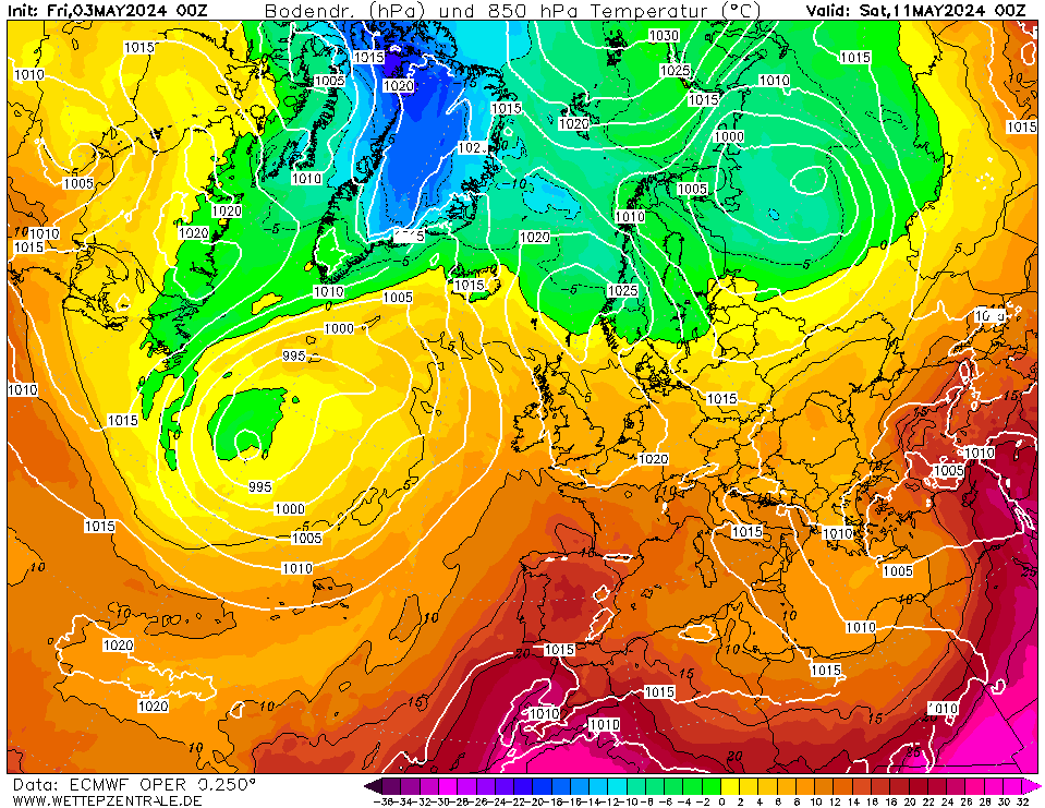
While subject to change, the two key things by day 9 on the GFS, GEM and Euro are..
1) They all shift the vortex away from the Atlantic as they ride our block north, eventually they'd dump into Russia. This basically reduces pressure on our block.
2) By day 9, they all have a second low by the Azores putting energy into the southern stream. So long as you don't have weird GFS style fizzle out then it's likely to either undercut or encourage the high to retrogress. Either outcome is good in our bid for surface cold and frosts.
So long as the modelling does not change drastically then yes, it would suggest that the Euro weeklies were right for week 2.
-
3
-
-
We are forecast 3C on Sunday morning which could be interesting.
-
52 minutes ago, Derecho said:

Quite a temperature gradient there from here to Scandi, if only it was winter!
I'm enjoying the settled October output at the moment after the end of this working week. Quite chilly this weekend but also refreshing
Very similar to the GEM evolution but a day or two slower. We'd likely see the hight hold out since it's fairly far north and linked (no path over for the low) which would hopefully see the low attempt more of an undercut.
-
1
-
-
Just now, Don said:
The only snow event I experienced during winter 2014/15 was an un-forecast event early on the 4th February, but it had all gone by lunchtime. However, it was an improvement on the previous year!
The main thing I remember about 2014/15 was the Eurasian October snow advance index, which created lots of excitement in the run up to winter, but ultimately failed to come off as being anything of note. Heard very little about the October Eurasian snow advance index since!
I think it had a handful of unexceptional events. I recall Boxing Day producing via a secondary low and something in February which was probably the same event.
-
1
-
-
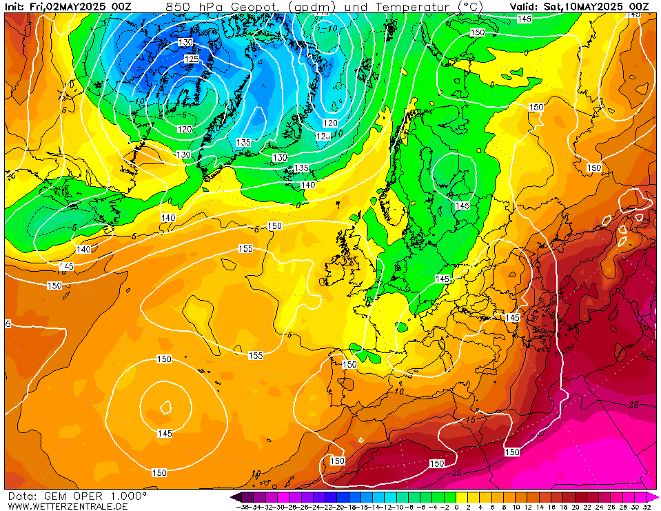
GEM would be pretty fantastic if it were January. Atlantic is being pulverised.
Days 8 and 10.
-
2
-
-
7 hours ago, Addicks Fan 1981 said:
According to this our cooler interlude is brief before temperatures 🌡 rise again.
Time-longitudes diagram - Extended range forecast
CHARTS.ECMWF.INT
This is a time/longitude diagram (Hovmoller diagram) of 500 hPa or 1000 hPa mean height anomaly (contours) and spread (shading). The mean anomalies are derived from the ECMWF extended...Did not expect to say this because it normally is wrong but I think the Euro weeklies and Met Office are onto a winner.
We are about to couple in just about the best position tropically for a +PNA/-AO pattern.
Blocking to the north and east likely in the final third though we should beware..
- +PNA over warm SST's could just juice the jet
- Always a risk of west based -NAO response
- Blocking centered to north and east can always sag and we can still draw warm uppers.
-
5
-
-
1 hour ago, BruenSryan said:
Surprised, was a pretty good fall as far as polar maritime is concerned though it was gone quickly as with nearly all PM episodes (minus January 1984). I believe the video below is from Meath though not 100%.
C3S seasonal models are out now for anyone that wants to check.
Charts | Copernicus
CLIMATE.COPERNICUS.EUParticular interest from the UK Met for November and December...
Do we have the January and February and March charts.
-
Just now, NEVES SCREAMER said:
Just my recollection. It's not scientific.
Essentially it just depends where you set the bar.
Winter 09/10 was cold throughout and the coldest winter in 31 years with a sub-zero mid Dec to mid-Jan period.
Equally though, Dec 10 and Jan 13 were exceptional.
More recently, Dec 22 was the coldest since 2010 and the first half was the 12th coldest on record. Jan 21 had the first half of January the coldest since 2010. The second half the coldest since 2013. The first half of February 21 was the coldest since 2012.
-
1
-
-
32 minutes ago, NEVES SCREAMER said:
Like hot summers. Cold winters are few and far between. Brilliant summers for me 75 76 83 84 89 90 94 95 96 03 06 18 22. Winters don't etch on my memory so much but I remember 79 81 87 95 09 as being cold. Maybe missed one or two.
The question is essentially how you define cold winter's.
05/06, 08/09 and 12/13 were all cool.
-
1
-
-
53 minutes ago, Don said:
Yes, winter 2014/15 wasn't too far from average, despite being Atlantic driven.
While it did feature a persistent +AO, it did feature high pressure either west or at mid-lattitudes which meant that while the hemispheric pattern was very different, our experience was basically a poor man's versions of winter 06. Weak north westerlies or blocking until quite late on. We did get a pretty zonal spell around early January though.
-
1
-
-
33 minutes ago, SqueakheartLW said:
2018/19 was WQBO by the time winter arrived, it was also descending solar, roughly in the same place as 2006/07 and was also just weak Nino too.
The SSW was the big let down for this winter as it failed to propagate down like around 1/3 SSW's.
It did propagate to be fair (or the second burst did) but it was just quite late on.
It was also not really a strong thumb but rather a succession of hits from late Jan, that just happened to cross the line. That's probably why it was not the best propogator.
-
1
-
-
6 minutes ago, Don said:
No, me neither. I don't think it's anything like as poor as it's reputation suggests! I believe it picked out March 2013 months out also.
It has got some very anomalous months correct but has gotten a tonne of inconspicuous months wrong.
That suggests there might be a signal that very hot/cold months out that it can detect but broad patterns it's still pretty poor with.
-
2
-
-
1 hour ago, razorgrain said:
I don't recall anything spectacular either way for winter '21, but I think that was the year when we had horridly cold northerly breeze in May. I was in Manc with mates and wearing my winter jacket still. Come to think of it, was it NYE 20/21 when we had that crazy mild spell? I was out in a T-shirt on that day.
Jan 21 had a CET of 3.1C and the first half of February was the coldest since 2012. Apparently, not all areas got much snow though.
-
1
-
-
1 minute ago, Mike Poole said:
20/21? Just the one snow event, about 3 inches here, I know others faired better, but no it didn’t butter any parsnips locally at least!
Interesting. Produced the highest number of attempted (mostly frontal) snow events since 2013 here (albeit no significant depths).
-
1
-
-
3 minutes ago, Mike Poole said:
The bold bit is standard procedure these days, isn’t it?
(Last time it came good was 2018, and even then it paid off in March rather than winter.)
You were not a fan of winter 21?
-
28 minutes ago, Met4Cast said:
It does make you wonder if the ECM is more aggressively factoring in the +IOD compared with previous updates, something has led to a rather dramatic flip within the seasonal output. Having said that, because of such a flip and very little consistency it’s difficult to put any degree of confidence in the outputs.
The wildcard for this winter is the eQBO + El Niño combination increasing the likelihood of an SSW, but if we’re going through winter hoping that 1) an SSW occurs and 2) it propagates downwards and imprints on the troposphere in a way that leads to UK cold, it’s going to be a long, nail biting “chasing the pot of gold” style winter!
It’s still too early I think. We need to see how the polar vortex develops through October & November, will be be strong & uniform throughout the atmosphere and coupled to the trop? Will there be a disconnect?
We also need to see whether or not El Niño will fully connect with the atmosphere, it’s currently giving it a go with an increase in westerlies across the Pacific and a recent rise in AAM tendency, although that looks as if it’ll be short lived. We need to see how this progresses in the coming months too.
All in all, a very, very tricky season to forecast.
Do they produce 200hpa vorcity charts for the seasonals, that would indicate if things have changed radically in the Indian Ocean.
-
Just now, cheeky_monkey said:
Looking forward to this winter here...everything looking back at previous strong El Nino points to mild relatively snow free and dry winter with an early spring..in my part of the world El Nino seems to trump everything else
My early analysis pointed towards you potentially having a colder and snowier December and March but probably being largely mild and dry through January and February (of course, I imagine in your part of the world that's minima around 0C rather than -20C).
-
- Popular Post
- Popular Post
2 hours ago, Addicks Fan 1981 said:The positive IOD in winter 2019-20 basically ruined the winter. It was very mild right
 ️ from the beginning to end.
1 hour ago, bluearmy said:
️ from the beginning to end.
1 hour ago, bluearmy said:It can’t be as simple as that
the atmosphere is way more complex than that. I don’t doubt it was contributory and it may have been the most important factor but there are instances where a positive IOD has not correlated to a mild winter for nw europe
While a high amplitude IOD is not good, it's not currently functioning in the same way.
In 2019 we were basically in a +IOD event that gave the east Pacific enough scraps to be near El Nino, this meant that we saw persistent convection through Autumn in the Indian Ocean.
(Sadly i only posted one of these charts once in the Nino thread that Autumn)
Basically the reality was that waves started strong in the Indian Ocean and then got a bit weaker than that forecast as they progressed.
Contrast that to this Autumn where even if the Nino is fighting the PDO and Nina legacy (struggling to couple strongly), it is a Nino driven pattern and the Indian Ocean is dead (the IOD is producing convection but well west of 2019, over Africa).
Dominant forcing here is over the west Pacific rather than Indian Ocean.
..
We probably still have to worry about the IOD but its clear that the forcing is being driven elsewhere this time.
-
5
-
 5
5
-
4 minutes ago, blizzard81 said:
Yes, I remember reading about the last week of October being the crucial one. I think exactly the same about that now as I did when I first read it - It just seems incredibly time restrictive. To pin it down to a specific week in a specific month just doesn't sit right with me.
The strongest coorrelation is week 4 of September through week 3 of October.
-
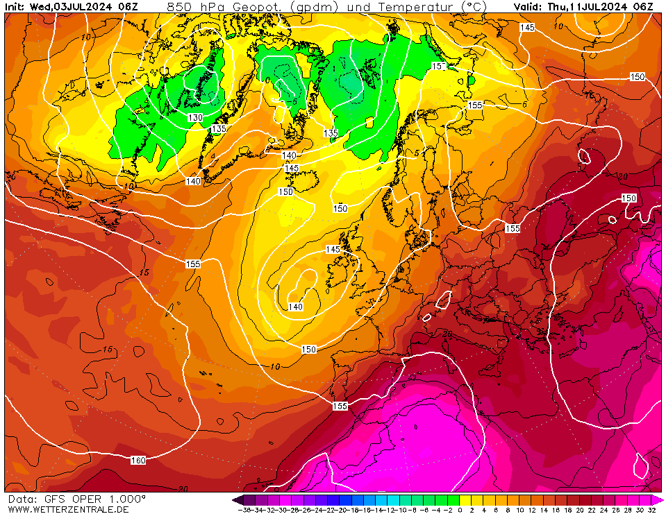
Euro takes until Thursday to push the cold front through.
GEM is the same to complete.
GFS is pretty messy, dumping the very warm uppers early but never completing.
- The complicating feature for the models is a small low that forms over the weekend and moves a dead cold front south. It pushes the proper warmth near the south coast where it then festers a few days.
You can see its impact on the airmass above despite warm uppers hanging around.
-
2
-
-
8 minutes ago, Derecho said:
Ah was too young to remember 2000 or it all fell as rain here! I can recall the school fields being flooded though. I think 2010 had a few chilly northerly days as well but nothing producing snow.
I don't believe it was forecast but there was snow on the ground as i was leaving for Middle School.
FAX charts suggest the 31st as i recall a storm a day or two previously and they show a north westerly afterwards (a mighty secondary low - it was the thing without a number undernearth 972mb).
Strengthens from about 1004mb to 976mb as it approaches Ireland.
Then it merges into the wider cyclonic complex.
But yeah, as it passed through on the morning of the 31st it must have produced.
-
2 hours ago, sebastiaan1973 said:
Winter 1878 was terrible. Here you see De Bilt Netherlands. No skating.
For the UK it was basically an average December and January and mild February before a cold March. Applying an extra degree for climate change and it would be a fairly poor winter and then perhaps a SSW causing spring cold.
-
1
-


.gif.083d1bd559118c1d3f8e321dbc45d6dd.gif)


E.N.S.O. Discussion
in Spring Weather Discussion
Posted
JAS ONI came in at +1.3.
To update our list and ranking.
Our updated list for AMJ.
1957: +1.3
1972: +1.4
1976: +0.4
1986: +0.4
2002: +0.9
2009: +0.6
2014: 0.1
2018: 0.2
2023: +1.3
We remain joint second.
To update on our ENSO trades index, September weakened a little to -0.3 but remained net westerly.
https://www.cpc.ncep.noaa.gov/data/indices/cpac850
To compare to our primary analogue list since 1979 (standardised):
1986: -0.4
2002: -1.0
2009: +0.4
2014: -0.1
2018: -0.7
2023: -0.3
Remember that our analysis last month showed a corellation between how early the event coupled and eventual strength so this may be another sign that the models are OTT (i still lean in the +1.3 to +1.7 range).