


That ECM
-
Posts
3,940 -
Joined
-
Last visited
Content Type
Forums
Blogs
Gallery
Events
Learn About Weather and Meteorology
Community guides
Posts posted by That ECM
-
-
12 minutes ago, SLEETY said:
Writing off the entire winter because the op runs bring in the Atlantic mid january

I'm also quoting this post in a few weeks, not as if the set-up after this week would take much for it to go back to cold again.
Let’s be fair. Not what he said. He said into February possibly back end. No mention of winter done from him.

-
- Popular Post
- Popular Post
The first chart T120 ecm. If ever there was one that shows why anything past T120 is JFF then this is it. Met did their piece on track of low and what was likely and then the two less likely. None of their deep dive had it tracking this far south.
second chart T48 ecm we’ve been watching this pattern come nearer for ages. Some said let’s get this in to the reliable and see what happens. Unfortunately for many it looks like snow will affect some but not as many as hoped.
final point. The skilled imo people who can look at background drivers and give an idea of a general pattern have been spot on. Do not judge on the basis that you haven’t got snow in your back yard.
Looking forward, it is suggested by the same people that a blocking set up may well be evident in the near future. Now I for one am pleased about this and will continue to look at the output to see. If blocking shows up in late gfs output and ecm then I will again only be looking at T120 plus JFF even if the met do another video.
Anyone who claims they knew the details of this week awhile go is talking rubbish.

-
 13
13
-
 2
2
-
-
-
1 minute ago, BLAST FROM THE PAST said:
MacD…….
BFTP
@tight isobar translate please.

-
5
-
-
5 minutes ago, Connor Bailey Degnan said:
Weeks of potential has turned into a week of cooler than average conditions and frost. I fear many people will feel exactly the same. Been well and truly taken up the garden path once again.
Yeah, much better to look at this where there’s no garden path, no potential no interest no will it won’t no very cold week with bits of snow about.
Thanks gfs for this chart. Miles better.


-
4
-
-
Track still not decided as expected.
-
4
-
-
6 minutes ago, IDO said:
...and by D16:
Let us hope you are right, but this represents the mean and is consistent with the last 2-3 days' FI output. Looking on Twitter, I do not see anything that would make this an outlier scenario. Since repeated designs are a good starting point for Winter patterns, we got 3+ weeks of zonal after the previous cold spell. But as you imply, just for fun, or not!
Can’t keep up on here let alone going on any other sites so not sure what has been said or not, genuinely. I of course could be completely wrong and we end up there. Jeez I hope not.

-
2
-
-
4 minutes ago, IDO said:
Looking at the T210 chart it is horrible; a harbinger of changeable weather for the foreseeable with the tPV circling to the N/NW:
T210:
Fast Forward three days and deja vu:
T306:
Consistent stuff from GFS in FI rather than chaos, and usually that means a strong signal.
Save this one and see if resembles reality. I honestly don’t think it will. Time will tell.
-
3
-
-
I wouldn’t call from 24th onwards. Too much going on in the output to be confident in anything. With the nhp as is a few tweaks good or bad would look very different later. FWIW I’m encouraged by what ukmo shows and how gfs is moving to it.
-
5
-
-
-
2 minutes ago, Lampostwatcher said:
Snow charts and useless as a chocolate tea pot at 6 days away
He was using it to show track of low on this run.
-
1
-
-
1 minute ago, IDO said:
The low is further south on this run, so I expect very dry south of Birmingham for the next 8 days:
You are going to awaken someone. Is there a name for it?
-
1
-
-
Each run it edges more to the ukmo.
-
7
-
-
Let’s see if it is even more of a straight northerly .
-
4
-
-
- Popular Post
- Popular Post
1 minute ago, mulzy said:Day 6 MGREPS sno-depth chart - take with a pinch of salt but it does show the southern runner is probably a 30% chance of impacting parts of the south (even as north as the Midlands in a few solutions).
-
11
-
-
1 minute ago, BremX said:
Oh it's amazing how the "I told you so" brigade come out.
Even if things revert to mild and the potential colder weather doesn't materialise, there are no kudos to be given to people like that. We know the normal set up for this country, it takes a lot of things in place to get the sort of weather that most on here are chasing.
A lot of people with a lot more knowledge than I have looked at so many different factors and shown that there is a possibility that it could line up right for cold and wintery weather.
If it doesn't happen it's not their fault, it's just something else has overridden the other signals.
Looking at the charts today, personally I would say, given how much the models have flipped over the last week alone, by this time tomorrow, things could look totally different again.
GFS is always wanting to revert back to type, to overdo low pressure systems and basically mug us off.
ECM, while perhaps more steady, can be just as wrong.
Other models can show us nice charts, or bad charts depending on which ones we pick.
There is still a lot more runs to go, the cold is deepening on this initial northerly, which, whilst probably dry for most, is still winter weather.
Let's get the cold in and see what the models make of it after that.
Agree and because ukmo doesn’t go past T168 it’s often overlooked.
wrt to fax chart above, I think it will look quite different when they draw the next one after the overnight output.
-
1
-
-
-
Just now, Kasim Awan said:
To me it looks like models are trying to prolong the cold spell with height rises to our SE, such as on the GEM this morning. The energy coming out of Canada also looks to be tilted on a NW/SE axis so wouldn't take much to disrupt East and produce an easterly by day 8/9.
We agree.

 until T144 is on a similar page. Milder maybe. Very different to mild.
-
3
-
-
Just now, TSNWK said:
ECM going with metoffice and cold leaving from next weekend.
Maybe but as they have cloudless skies at the same time as this, they have different view on how we get there.
-
-
T144. Confidently can say it will be cold. Other than that?
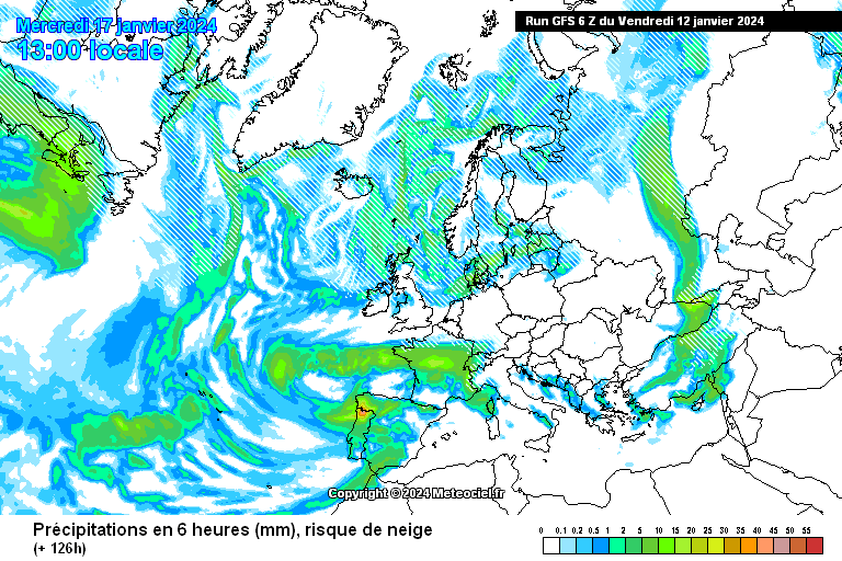
Atlantic barrelling through?
-
3
-
-
T120. Greenland can not be agreed on. Next weekend Atlantic barrelling in?


Model Output Discussion - Colder but how cold and for how long?
in Forecast Model Discussion
Posted
Dry zonal please.