


.jpg.66eb1d612a19e333068352f9a1a6b9ea.jpg)
.jpg.689334a3abd90b862654383e9bd4ca03.jpg)
wiltshire weather
-
Posts
299 -
Joined
-
Last visited
Content Type
Forums
Blogs
Gallery
Events
Learn About Weather and Meteorology
Community guides
Posts posted by wiltshire weather
-
-
27 minutes ago, Lynxus said:
Some very interesting growth to the south currently.
Circle 2 (second from left) i think is what the MetO were alluding to for the red alerts..

Looking at the Meto video forecast you're about right, although it all seems to feed into the red warning area snow train keeping it going all night!
-
The Thursday night video forecast on the Meto website shows the freezing rain area expanding a bit and then fizzling out around 1am.
Then around 0500 the snow starts building again across the region and looks like it keeps going most of the day!
-
 1
1
-
 1
1
-
-
Good call from @Bring Back1962-63 on the Meto needing to update their warnings!
-
1
-
-
Just now, matt111 said:
Wasn't that the one that showed deep snow across more or less the whole region?
It was I think, been pretty good this week, even getting the showery snowfall pretty accurate.
-
The precipitation model from the HIRLAM seems uncannily accurate right now, hope it unfolds as this shows:
-
3
-
-
That's an impressive wedge of snow heading up towards Bristol, also all along the coast from Portsmouth to Lands End!
I seem to have a growing 'light patch' over me at the moment but am hoping the intense stuff arcing down towards Paris is headed my way!
-
2
-
-
2 minutes ago, Fred Sykes said:
can anyone hazard a guess as to how far east the really heavy precip currently in the channel will get? Nearest town? will it be further east than predicted?
Best bet is to watch how it evolves over the channel and see if it expands eastwards I think.
-
I think this has edged further east than even the latest forecasts (which is a good thing I believe!)
The latest ARPEGE run has this scenario at 1600 our time:
Whereas the reality is a definite eastwards extension of the precipitation to the south of us:
-
2
-
1
-
-
1 minute ago, Bring Back1962-63 said:
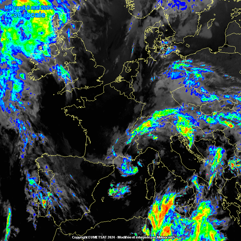
http://www.meteociel.fr/observations-meteo/satellite.php?mode=animation-infrarouge-colorise
A few of you are still misinterpreting these charts
The vast majority of our blizzard will not move up from France and Biscay - it will develop rapidly much closer to home in the Channel as the flow engages with our dense cold block and tries to under cut it but rises over it. So watch both the infra red satellite as well as the radar. In about an hour to two hours (1630 to 1730) there will some mind boggling developments. David
Thanks for that David, good point well made!
-
This in itself is incredible!
-
1
-
-
2 minutes ago, SilverWolf said:
Think so! Please can you put a link for that radar on? Thanks
You can find them here : http://www.meteociel.fr/observations-meteo/satellite.php
-
My Meto app has been all over the place today.
First of all it dropped all my snow today to just patchy light stuff and changed it to nothing at all tomorrow, now its got light snow the rest of the day, heavy stuff from 2200 for a couple of hours, the Friday batch has been put back on from 1900 for the whole night and now also snow all night Saturday into Sunday!
The warm-up has been put back until Monday
-
Just now, Jayfromcardiff said:
Very heavy here, proper blizzard conditions gusting over 40mph.
Certainly looks like you're in the direct firing line for the heavy stuff as per your Meto red warning.
-
1
-
-
Afternoon all. Had to drive some of the family around this morning as I'm the only one with a 4x4, great to finally use it for it was intended!
Had light snow here most of the day and bitter windchill. Temp hovering around -3c. Certainly everything is getting a covering, but its difficult to tell how much with it blowing around all over the place!
Currently watching the radar with all that snow heading our way, glad virtually all of us are getting in on the action!
Love that update from David ( @Bring Back1962-63) - great to see the area of precipitation expanding as it moves up towards us.
I'm still hopeful the HIRLAM output is more correct than the ARPEGE as it expands the snow eastwards whilst keeping all of our area with all snow.
Here's the 1900 predictions from this mornings run:
You can see the eastern extent is quite a bit further over on the HIRLAM which is what it would be great to see before it wheels around to the NW.
Judging by the current radar, it looks to be going that way:
-
1
-
-
1 minute ago, Kreftysoton said:
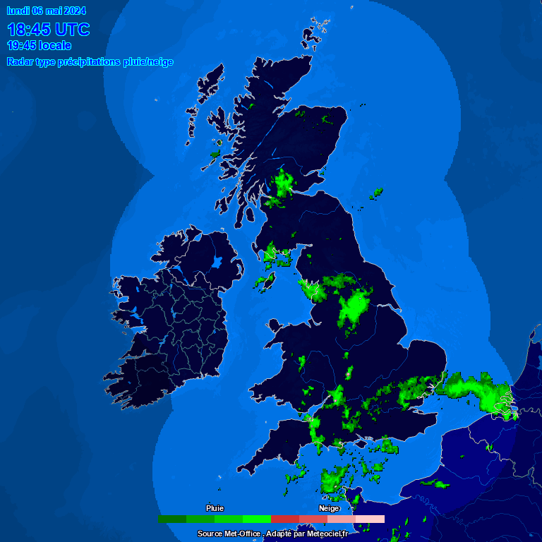
Does anyone know of a radar for france so i can see if southampton will get hit later today or missing it? Also will it be snow for soton or rain later? Its -3 at the moment still.
Netweather one has a European option you can turn on
-
Amber warning area has just been shrunk, I'm barely on the edge of it now!
Time will tell if they got that right....
-
Hirlam is pretty accurate for the current conditions!
-
2
-
-
6 minutes ago, jethro said:
Morning all, woken to a good covering this morning and it's coming down well, probably class it as moderate snow with the flakes getting bigger. Can't say I'm looking forward to work today, it's going to be a chilly, albeit pretty day. Looking at the METO (which hasn't updated) I'm not due to be having any snow until lunchtime/early afternoon so I guess this is an appetiser.
I'm probably asking an impossible question but.....does this early stuff mean the track has changed? Are we likely to get more or less than thought or does it make no difference? I'm asking because I was a little gung ho yesterday and have promised I'll be at work to day, not a problem in a landy but if it comes earlier/heavier than expected, it will be a problem getting home, due to others getting stuck and having to make it up to the top of the Mendips in drifting snow.
Thoughts anyone?
I still think the Hirlam had performed best at getting the snow right over the past few days. Here's what it predicts for today and tomorrow.
-
3
-
1
-
-
Been lightly snowing for a while here and have a light covering on the ground.
If you turn off the precipitation type on the NW radar the heavier stuff shows up better and i can see a heavier band moving up from the south which should give us an hour or so more heavier stuff here i hope.
-
6 minutes ago, Sainsbo said:
Looks like the HIRLAM and ARPEGE (12z and 00z respectively) are keen to give a good covering for central southern areas along with areas further SW, whereas the GFS/NMM and ICON (12z's) aren't interested at all. We're only 30 hours away and the snow depth ranges for central south are anywhere from about 1 to 15cm!
Looks fine to me, just about!
-
My Meto app has also just updated and to my eye seems to follow the ARPEGE precipitation pattern almost exactly!
-
2
-
-
2 minutes ago, AWD said:
12z Hirlam snow depths by midday Friday;
I'd happily bank that!
-
3
-
-
1 minute ago, ptow said:
That's got snow over Reading but there wasnt any
Yes, the radar does seem to show some 'ghost' snow at times, been pretty accurate for me though so far.
Hoping there won't be any such issues tomorrow with heavier precipitation!
-
6 minutes ago, That ECM said:
I would say that's a little further east than previous but happy to be corrected.
Looks that way to me too. I still think it may do looking at the current satellite pics and looking where the fronts currently are.
-
1
-


South West and Central Southern England Regional Weather Discussion 22/02/2018 Onwards
in Regional
Posted
So looks like tomorrow is shaping up to possibly be another day watching the radar, although as @nick sussex mentioned, nothing set in stone yet.
Moderate snow across most of the region with a wind gusting to around 30mph so still blowing around.