


Yorkshirepudding
-
Posts
333 -
Joined
-
Last visited
Content Type
Forums
Blogs
Gallery
Events
Learn About Weather and Meteorology
Community guides
Posts posted by Yorkshirepudding
-
-
10 minutes ago, sorepaw1 said:
My subaru here about to challenge a 2ft snow drift.
For the record it manages it no problem.lol
Are we all ready for another Easterly blast next week from the north east this time our turn for an amber warning
Just been greedy really lol..
Enjoy folks anyone wants advice on subaru cars message me I've had Subaru's 23 years.

Are you a troll trying to sell 4x4 Subaru’s??
-
16 minutes ago, LeeSnowFan said:
Everyone has gone quiet on here on mod thread what's happening
It’s the Lull before the Storm..
-
 1
1
-
-
Very quiet in here given the uncertainty of the exact track of Emma.. Anyone got any new info? We already know the storm has tracked slightly further east but does anyone fancy putting all their eggs in one basket regarding their thoughts of how far north and east it will affect?? Seems a lot of uncertainty between models etc so just looking for a few second opinions..
Thanks in advance. TY.
-
1
-
 1
1
-
-
10 minutes ago, yaffle said:
Sorry for late reply but the pale blue area north of York is just ghosting. It's pretty much over my house and we've had nothing since 1100ish.
Having said that @vizzy2004 may have had some snow up on the ridge.
Thanks for that buddy
I thought as much.. ?
-
6 minutes ago, Bradowl said:
Most of this area that's showing precipitation on radar are seeing no or very little snow.
Blowing snow confusing the Radars?
-
9 minutes ago, summer blizzard said:
Doubt we'll see showers though one near York has not moved in about an hour.
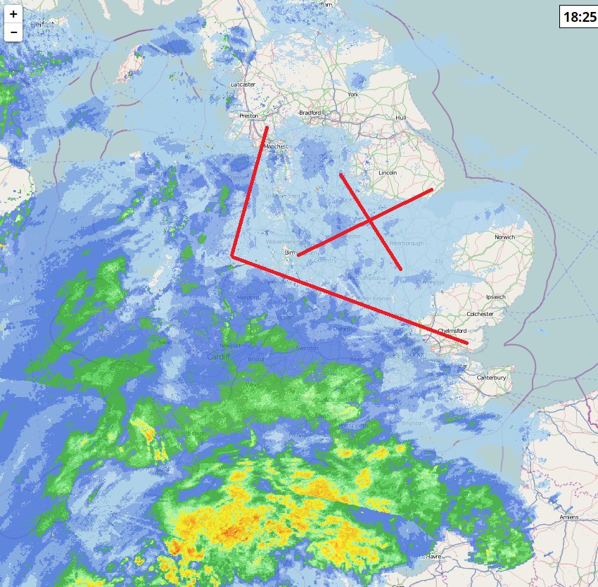
Can anyone report from west of Sheffield, there's a more solid blob crawling north to West Yorkshire (actually moving more NNW).
Haha. I saw that one near York surly that is radar confusion with the blowing snow..
Anyone from there confirm?
-
1 minute ago, wozafax said:
@Yorkshirepudding That's interesting. My app has no snow at all for tonight other than the odd shower between 12am-2am
Looking at the radar I'm not sure any of that snow to the south will make it this far north? It'll be interesting to see what happens..
I have no idea pal these apps are all over the place. Calendar has us in the Northern half of West Yorkshire and North Yorkshire for showers tonight/early morning but yet we still have Emma pushing up so how are showers going to come back south to include us if that low is pushing up..?
-
I suppose we will see...
-
18 minutes ago, cobby said:
Had a walk down Fishbeck Lane this morning and you could get a 4x4 down maybe
More Brown bank and Straight lane that has had trouble as these are more Exposed to the winds.. a few pics to get an idea..
-
2
-
-
14 minutes ago, Barking_Mad said:
Leeds Council told me that they expect further snow showers, but main reason for Amber warning was for drifting snow. *shrugs*
Makes sense as for instance the road that leads over the tops near the Moorside from Silsden to Addingham & Ilkley has been closed or at least was closed. I suppose when community’s and roads are getting shut off due to drifting it definitely warrants a warning.. however it would be good for them to be a little more clear.
-
1
-
-
It looks like it’s gathering intensity perhaps this is behind the Amber and Yellow update earlier.. If that’s the case then the forcasts have been all over the shot. I don’t think it was forcast to be as high as it is already.. Time will tell I guess..
-
So we have just received a updated Yellow warning for Friday & Saturday with snow showers forcast to hit the northern half of the region.. giving additional 5-10cms each day to places with the most frequent showers.
Edit: I’ve just watch Look north and say the showers Friday will be light and patchy with the potential for Emma to reach the Humber if not further north Friday night into Saturday. Still very unclear as it seems forcasters are contradicting each other..
-
3 minutes ago, John Hodgson said:
Hello Yorkshire folk. I’m on my way from London trying to get to Leeds however no trains are running. Wish me luck.
also who turned off he snow machine? Does anyone reckon we’ll get anymore over the next few days?
North and Western areas are currently looking like the best bet for more snow over the weekend.. but like we have been saying all morning this Beast keeps on surprising..
-
2
-
-
1 minute ago, Kathryn Atkin said:
Thoughts on South Yorkshire? My colleagues are wanting to know if they’ll be working from home again tomorrow or trekking into sheffield
Honestly I have no idea.. ?
i think unless Emma pushes up quicker than expected or we get another surprise from the North Sea i would say tomorrow is looking better.
He says while the snow peps up again. Lol
-
17 minutes ago, richardc1983 said:
Will it be colder tonight than last nights minus 6? Temp curently -1.8C
It should be slightly warmer tonight but still below freezing especially in hills and rural areas. ?
-
2 minutes ago, Northern Sky said:
This cold spell is costing me a fortune in bird food! They really need it though, a spell like this is very tough for wildlife.
See the deers on the news coming down from the hills in Scotland into the towns looking for food?? Even they’ve forgot what to do in this kind of weather. Lol.
-
1
-
-
Ok the snow is just about fizzling out for my location now still falling but light in nature but very windy.. since about 5am this morning I reckon I ve had an additional 5” judging by what has been cleared and now is now recovered since Tuesday i think I’ve had about 15-16” in my location.. More snow is obviously always nice as long as everyone is safe but if we don’t get anymore I can’t complain. However I still think this Cold spell has a few more surprises up it’s sleeve.. With cold temperatures and overcast conditions snow will be hard to shift until after the weekend at least. Let’s hope for a big fight from the beast. We could still end up seeing some heavy snow storms as the warm air hits the cold going through next week.. until Emma moves away and brings us a touch more confidence with the models.
-
12 minutes ago, steve378 said:
Some pics from Todmorden
Nice pictures thankyou very much for sharing ?
-
1
-
-
11 minutes ago, shetland islands said:
The revised yellow and amber warnings maybe due to the initial front being further north. It may also be that as this pushes into Lincolnshire, North Nottinghamshire and S Yorkshire it may intensify as it meets the very cold air and strong SE breeze aiding convection. Not sure, but a possibility.
I think its proven during the last 3days anything is possible.. lol.
-
So the latest calendar forcast says..
Showers slowly fizzing out with a few isolated showers more north but nothing of any worth same moving into Friday showers increase slightly for North and West Yorkshire in the afternoon on Friday.
So why do we have a Amber warning that has just been inssued for further significant snow until 10am tomorrow? Unless they’re using a old Model? I’m increasingly suspicious the met office have been late to issue the warning and there covering themselves because in all honesty it should of been issued before anyone thought about the early commute to work etc.
-
I’m in a state of... “ I don’t have a clue what is going on “ I expected the warning to be upgraded lastnight early morning. Not now the showers are calming down.. I can only think it’s now for the drifts etc but who knows anymore I give up..
lol
-
2
-
-
26 minutes ago, Yorkshirepudding said:
I’ve been asking the question in the Model thread etc if anyone has a clue how far north Storm Emma will get no one has replied as I really think no one actually has a clue.. the lull in the showers is due to the low that is pushing up and then dragging further Showers down again tomorrow. But I honestly have no idea what exactly is going to happen this storm is very complicated to predict.
Already they’ve said it’s much further west than they first thought pushing up before rolling west towards Ireland then the second wave moves in tomorrow which is what some models had that moving more NE towards our region again no one is prepared to make a full forcast for tomorrow. In March 2013 it was a long that pushed un in a similar fashion and stalled over our region blowing back in on an Easterly wind that made it look like it was coming from the North Sea which gave us massive snow drifts although the snow wasn’t particularly heavy in the form of the size of the flakes as it had lots intensity moving up through the uk.. Theres still potential for it to do a similar thing but again it’s so hard to nail down I literally don’t have a clue what is in store for us over the weekend. It could either be that the storm reaches us and give us 24-36 hours of continuous slightly lighter snow creating snow drifts especially over higher ground. Or the Storm keeps south and we drag in more showers from the east Friday and Saturday wether or not these will be heavy in nature only time will tell. Although it does look like it will get slightly warmer it could create a battle ground for our region as lows try push up from the S/SW bump into our stubborn cold air and readily turn to heavy snow. Whatever happens I still think we are in for an interesting Weekend into next week..
I meant further East... I’m sure you all knew what I meant ???
-
33 minutes ago, cowdog said:
March 2013 was odd, in that over Skipton way it was bad, but just on the border and around Colne & Clitheroe it was a LOT worse. I know a few farmers near here lost their whole flocks as they got buried. 1 small village and a few hamlets that are less than 2 miles away as the crow files were completely cut off for over a week - the main A6068 (the road the M65 turns into) was shut for 2 days. All that wasn't so much the depth though it was the speed it came down just completely stopped everything.
I was cut of for two days while the Farmers not the council dug us out with an digger. Over the tops were a lot worse than they are currently as the winds was high for 36 hours along with persistent snow and I include cowling in that but in the valleys there was nowhere near what we have now. But in the fields of the tops there was no snow at all because it had all blown into the roads and against walls infact we had to walk on wall to get home and cars that was abandoned you could see nothing but a sunroof and others you couldn’t see at all. So from that respect March 2013 was worse but on a whole this spell beats that in respect it’s affected a lot more people.
Just my opinion of course and I’m only going on the area I was at the time.
-
1 hour ago, wozafax said:
So what's everyone's gut feeling? Is this morning the last heavy snow we'll get? Or do we think more is on the cards? MetO has the odd light shower through until Sunday before temperature recover. It doesn't look like the low pushing up with effect us so at the moment it's hard to see when/ if there is another dumping in the offering.
I'm not been greedy. I'm more than happy with what we have and it won't melt before Sunday/ Monday so if this is it I'll take it. I'm just interested to see what everyone else's gut feeling is, because there is no point looking in at the models.
I’ve been asking the question in the Model thread etc if anyone has a clue how far north Storm Emma will get no one has replied as I really think no one actually has a clue.. the lull in the showers is due to the low that is pushing up and then dragging further Showers down again tomorrow. But I honestly have no idea what exactly is going to happen this storm is very complicated to predict.
Already they’ve said it’s much further west than they first thought pushing up before rolling west towards Ireland then the second wave moves in tomorrow which is what some models had that moving more NE towards our region again no one is prepared to make a full forcast for tomorrow. In March 2013 it was a long that pushed un in a similar fashion and stalled over our region blowing back in on an Easterly wind that made it look like it was coming from the North Sea which gave us massive snow drifts although the snow wasn’t particularly heavy in the form of the size of the flakes as it had lots intensity moving up through the uk.. Theres still potential for it to do a similar thing but again it’s so hard to nail down I literally don’t have a clue what is in store for us over the weekend. It could either be that the storm reaches us and give us 24-36 hours of continuous slightly lighter snow creating snow drifts especially over higher ground. Or the Storm keeps south and we drag in more showers from the east Friday and Saturday wether or not these will be heavy in nature only time will tell. Although it does look like it will get slightly warmer it could create a battle ground for our region as lows try push up from the S/SW bump into our stubborn cold air and readily turn to heavy snow. Whatever happens I still think we are in for an interesting Weekend into next week..
-
3
-


Yorkshire & E England Regional Weather Discussion
in Regional
Posted
Would of loved to see the 2ft snow drift challenge would of been up to your bumper driving through it..