


frosty ground
-
Posts
4,589 -
Joined
-
Last visited
-
Days Won
1
Content Type
Forums
Blogs
Gallery
Events
Learn About Weather and Meteorology
Community guides
Posts posted by frosty ground
-
-
22 minutes ago, Steve Murr said:
can we read read the post to identify that there wasnt a winner declared -
just observations on form & where models sit-
Sorry when you wrote big win I assumed you meant winner.
I can only assume you can have a big win if you indeed actually win. -
10 minutes ago, The Eagle said:
ICON coming close to joining the dark side. No shortwave dropping down west of Scandi, but somehow may just hold it together.
 vS
vS -
2 minutes ago, Daniel* said:
The odds are stacked with the easterly contrary to popular believe.
By day 10 they are, but the short term AKA day 5 UKM is what is being discussed more.
-
12 minutes ago, Steve Murr said:
seasonality -ECM OP the biggest outlier in the suite-
I will do an update later but all ECMs failings this winter are still appearing in this current output
UKMO is the big win today NB following the IKON
The middle ground is still ok without the trigger shortwave delivering for UK - GEM shows the middle ground with a the correctly positioned WAA pulse north to build the high- ECM looks way to positivly tilted-
S
Can we declare a winner when we haven't past the finish line.
-
 2
2
-
-
18 minutes ago, Scorcher said:
I don't often follow the models during winter, but I personally think there is more to be positive about this morning if you want an early taste of spring.
It seems a lot of people on here pick and choose which model they favour from day to day, simply because it shows the colder option. The GFS or ECM Ops are not showing anything cold at all to my eyes- in fact we get mild southerlies later on on the GFS run (not excessively so, however).
The ECM does look very mild at times with more of a SW flow later on.
A lot of he models show early taste of spring to be fair, but then again early spring weather can be rather wide ranging.
-
2
-
-
3 minutes ago, jvenge said:
ECM Control is also not good for those wishing cold. The Mean seems to suggest both the Op and Control likely don't have much support among their own suites.
So, depending which way the wind is blowing (he he he, sorry), you can either decide that means are the way to go, or Operational's have seen the light (sorry again).
Cooked up some good puns there....
I would as i said yesterday stick with the operations at that range, of course the UKM may be right but its a 2 vs 1 (on established models)
Roll on the 06,12z,18z00z outputs -
High hasn't been pushed away mid term so it might not be cold but its not muld either.
-
Heights over Greenland building.
-
1
-
-
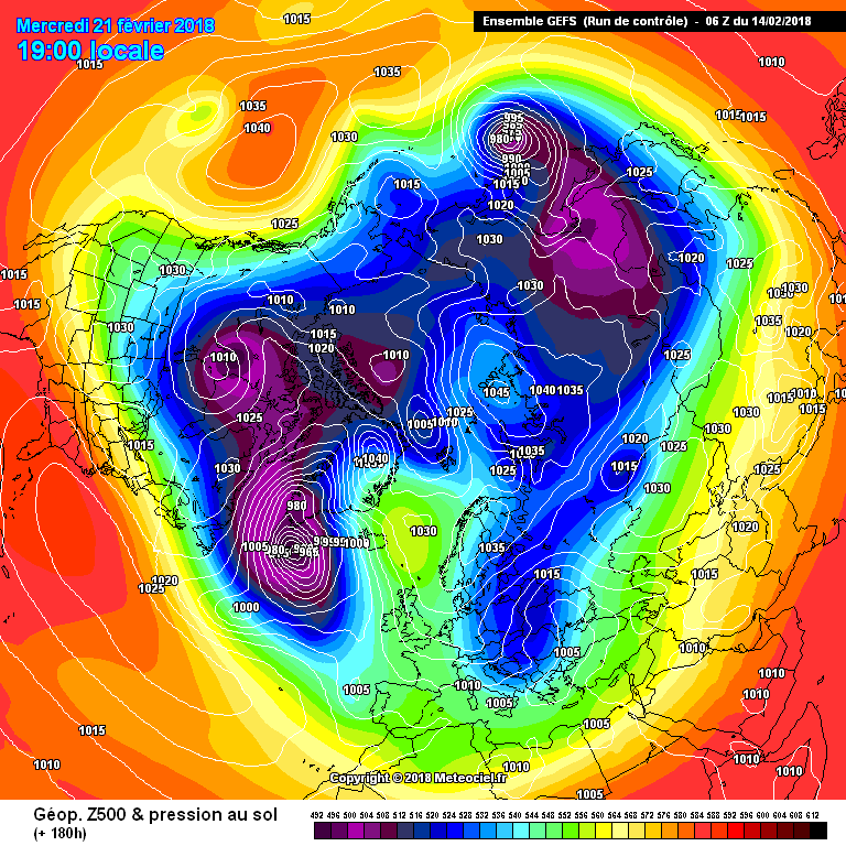
By 120 the low in the mid atlantic is missing. The ops are in the lead.
Expecting toys to be all over the place by morning
-
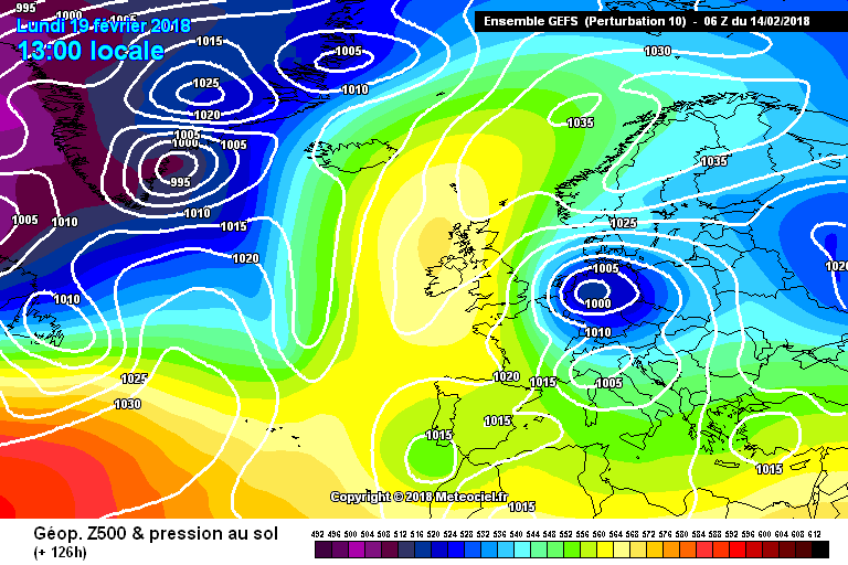
5 minutes ago, The Eagle said:
18z so far looks an even flatter pattern than the 12z. No GEM outcome here.
Looks identical at 108
Looks like a new outcome is favoured thou with any blocking not getting far enough north eatly on then pushed away east in the mid term.... mild rather than cold next week.
The ops are in the lead before day 5 and this is where the ensembles diverge
-
 1
1
-
-
GFS op run has plenty of support from the ensembles and the ecm has the same theme.... a new partern is emergng
-
9 minutes ago, frosty ground said:
Jet cutting through the south will keep any cold out of the way..... another run another outcome
Southerly tracking Jet but the cold air is bottled up as expected.
I think this will be a very mild outlier.
And it was a -VE West based NAO.-
1
-
1
-
-
Jet cutting through the south will keep any cold out of the way..... another run another outcome -
GFS hinting at a west based -NAO
-
Not many places it can go from here,
The low is dropping down the eastern flank being driven on by the Jet.
The high is being pushed west and north -
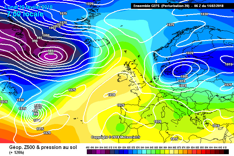
Differences are minute but the main area of focus is the amount of energy that gonna cut south over Norway. -
Just now, karlos1983 said:
ICON next Tuesday
Starting to drag in air from the east
Closer view.-
2
-
-
Quick return to cold is supported by 3 out of the 20 runs. -
Just now, karlos1983 said:
Control run prefers the impatient route, here here i say
Look at number 10 (already posted) I think thats the fastest route. (day 6)
-
1
-
-
A range of options at day 5 -
Well the GFS06z shows the possibility of a lot of snow fall then a lot of rain then even more snow, flooding could be an issue.
Some rather large temperature gradients over the UK too -
1 minute ago, bluearmy said:
Lack of continuity on detail persists
Atlantic much stronger on this run - likely overdone on a rounded feature like that
What time frame are you talking about?
The overall pattern is pretty much the same, and surely beyond 5 days that's' all we should be looking at? -
Just now, weirpig said:
Well very similar run this from the GFS compared to the 0z High advancing to the pole an easterly starting to bring in colder uppers by the later part next working week. wont be bone chilling up to this point but night time frosts again will be abundant.
Should be pretty sunny too away from the coasts.
-
1
-
-
If we can just get the Jet to curve back west rather than North to south, we would get the col in much quicker.


Model output discussion - Post SSW - Will it turn cold?
in Forecast Model Discussion
Posted
The GEFS 06z offer almost no support for the UKM run at day 5.

I think you missed the Irony in my post @Scorcher