


minus10
-
Posts
2,386 -
Joined
-
Last visited
-
Days Won
3
Content Type
Forums
Blogs
Gallery
Events
Learn About Weather and Meteorology
Community guides
Posts posted by minus10
-
-
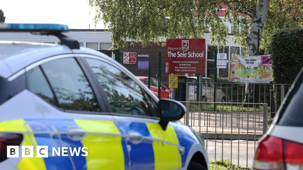
More info on the lightning incident at a Hertford school yesterday from BBC..
 Boy critical after lightning strike at school - BBC News
WWW.BBC.CO.UK
Boy critical after lightning strike at school - BBC News
WWW.BBC.CO.UK
A boy, 12, and a man are hit by lightning at a school football tournament in Hertfordshire.Thoughts with the families affected...hope those injured fully recover ...interesting the way the event occurred as explained by one of the parents ...
-
 2
2
-
-
19 minutes ago, Alderc 2.0 said:
Sad news - hopefully he can make a fully recovery.
In my sons football league theres strict rules about playing when thunder is audible. However very difficult to make a call if there’s been no thunder for a while, or it’s the first strike for a new/developing cell or it’s weak storm with intermittent strikes that’s moved in from another area.
Boy, 12, in critical condition after being hit by lightning at school football tournament in Hertfordshire
NEWS.SKY.COM
A man was also taken to hospital following the lightning strike during the tournament at The Sele School in Hertford on Monday afternoon.That must have been the bolt that occurred when i was outside doing a hedge at that time yesterday in Welwyn garden city..not that far away ..incredibly loud 'crash'...lets hope the boy and the man make a full recovery..shows how dangerous lighting can be...
-
13 minutes ago, Sprites said: Live video stream
G1.IPCAMLIVE.COM
Looks like quite a line of activity passing over Cromer/Sheringham...to top what has been an amazing day for shotgun thunderstorms...certainly not what i expected...October delivers again..
-
2
-
-
Been fascinating watching the elevated thundery cloud moving from the ssw while underneath the low cloud and indeed mist around the tree tops near me moving rapidly from the ese...
-
6
-
-
2 minutes ago, Flash bang flash bang etc said:
Amazing pic Flash...
Plenty of convection to my east moving ne..sky gone all misty again..what an afternoon..
-
1
-
-
Sky is just so volatile currently..
-
2
-
-
- Popular Post
Amazing skies..
-
10
-
-
Yes here we go again, flash and very heavy rain..
-
Yep more on the way...no thunder yet though..
-
Just reeling from that close strike..power went out for a while...realised i should have taken cover as soon as i heard the first rumble but tbh didnt think much would come of it...should know better ...dark again now...
-
1
-
-
Just heading to trim a hedge with metal ladder in hand when massive bright flash and huge crash ....put ladder and hedge trimmer back in van...now big drops...wow...took me by surprise....
Since then heavy rain and further thunder...its can only be October!!
Sorry for duplicate post..problems with internet
-
2
-
 1
1
-
-
Just heading to trim a hedge with metal ladder in hand when massive bright flash and huge crash ....put ladder and hedge trimmer back in van...now big drops...wow...took me by surprise....
-
2
-
-
Gosh it feels so stormy out even though just grey clag..had a few large drops and a rumble..
-
2
-
-
As with the 0z the 6z gfs op wanting to cool down quicker than the mean resulting in a more settled next weekend for south eastern areas...
..the mean trough not as deep or pronounced as the op even taking averaging out into consideration..
...resulting in warmer temps ...particularly for the south east..
..be interesting to see how this plays out given the warmer Ec run, tropical storms and @MattH comments above..
-
4
-
 1
1
-
-
Yea a really strange looking sky this morning..sun out but through a sheen of haze...
-
32 minutes ago, Eagle Eye said:
Given the streamwise vorticity already in place, any storm that can latch onto the surface flow behind the frontal system will likely be able to increase the momentum into the storm at a steady rate. The extreme LLS with backing winds is quite rare for the British Isles and if enough DCAPE can force enough energy downwards to rapidly increase 3CAPE, specifically in the lowest sector of cloud development then there may be potential for a strong tornado.
Given all that directing of shear, a Supercell is definitely possible. This is especially likely in the middle and southern sectors of the possible line, where there appears to be better stretching and veering of the low-level winds and directing of mid-upper level winds are better, aiding possible Supercellular development. SBCAPE is quite low for Supercellular development, however this appears to be acting on the models as a possible low CAPE/high shearing scenario, with just about weak enough forcing for it not to upscale too much compared to previous events in the past.
The updraft could well be centred away from the draft given the winds available so some good pictures of the storms are also possible. So if you're in the path, possibly might need your camera for this afternoon and into evening.
I think i know what cape is but Dcape and 3cape ?
-
Yes...in the shorter term its interesting to think that a chunk of energy separating from tropical storm Ophelia currently making landfall on the east coast of America
...could end up triggering this as per gfs 12z by wednesday..
...although lot of uncertainty it does seem that there will be a disturbance/low pressure/storm crossing the uk at that time...definately one to watch..this autumn turning out to be very meteorlogically varied and interesting with the tropics having a large influence on our weather...
-
6
-
-
Yep...convective afternoon coming up for some....
-
2
-
-
- Popular Post
Gfs0z wanting to settle things down for the beginning of October with the help of another tropical system..
..while of course its FI and at the top of the pressure ens..
...its not a complete outlier and is plausible given current weather pattern...
...eventual uptick on 850s..
...even the mean showing higher pressure for beginning of October ..particularly for the south..
...so although this is just one option i think after the unsettled period prior most people would welcome an autumnal spell of mists and mellow fruitfulness...
-
19
-
8 minutes ago, Southern Storm said:
Not strictly storm related, but I absolutely love this type of weather

Absolutely...although storms is what most of us want i always love convective weather with or without the thunder as you get the most beautiful and interesting skies with it..i have never lost that delight of watching convective skies since i was a kid ( few years ago..
 ) ...in fact i love it even more now if that is possible...lovely pics on this thread this evening ...
-
2
-
-
Phenominal cloud and depth and range of darkness and light..constantly changing...constantly evolving..
..my daughter out here also taking pics..
-
9
-
-
Think i can see hail shafts as well..someones getting it further east ...incredibly dark sky..
-
Showers to the east of us seem to be intensifying...real dark sky..
Yes thunder just heard
Edit..abd a beautiful rainbow now...maybe bit of backbuilding.
-
7
-


.jpeg.5df495e2df0d05a38a1a4037a8df60f2.jpeg)


.jpg.96cb5ac32ef514d679491224f27bf766.jpg)


Model Output Discussion - mid Autumn
in Forecast Model Discussion
Posted
Gds12z seemingly doubling down on the cold pattern from the ene with potential reloads..
...quite an amazing set of 850 ens from gfs as well..
..although at the bottom from around 18th..the op is supported by a small cluster...think it was mentioned in the met 10 day trend that the easterly option was given approx 10 % probability..so still unlikely given the ecm run referred to in the excellent comparison analysis by @WYorksWeather above, however still a possibility and certainly not at present anyway showing the typical zonal flow you may expect at this time of year...