


Paul Sherman
-
Posts
8,809 -
Joined
-
Last visited
-
Days Won
26
Content Type
Forums
Blogs
Gallery
Events
Learn About Weather and Meteorology
Community guides
Everything posted by Paul Sherman
-
 Excellent, loving this thread, so many memories, so many chases and so many great people who make it happen!
 -
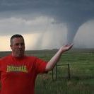
So today was supposed to be a setting up day, and that went amazingly well, with everything working perfectly, radio, grlevel3, dongles, cradlepoint, threatnet, mapping software, it all worked. Then the weather models and SPC Slapped a "See Text" risk very close by in Western North Texas so we thought why not have a tester chase to see if everything runs smoothly, now I have chased a few see text risks before and had surprisingly good outcomes, other chasers just will not entertain anything under a slight risk (each to their own i suppose) Chase target was Wichita Falls and we ambled up there for some lunch, the dryline was very evident about 30 miles to our west and we watched turkey towers go up and down until finally the cap was broken at about 6pm down near Abilene. A pair of quite weak storms were ambling along at 10mph to the ene so we went south to the town of Graham (Scene of Tour 2's Tornado last year on the 17th May) and positioned under the rain free base and edge of the hail core. A beautiful shear funnel danced up and down for 10 minutes and we took sporadic bursts of quarter sized hail, some nice Cg bolts were also raining down at this point. We headed east to Jacksboro and positioned just SE Of the storm for it's dying stages and caught some pretty decent structure to end the day. A nice way to blow the cobwebs off. Paul S - Our Position - Shear Funnel - Quarter sized hail - Nice structure

-
A lot of chatter in the chaser community getting excited about the upcoming May and a very active Pattern. First chases next week to test the equipment look to fall absolutely perfectly for us. Cant wait
-
Yes a pretty amazing outbreak, not hard to see why when you have a 90kt 500Mb Jetstreak stuck between 2 ridges, rinse and repeat unfortunately and with a tepid bath of the Gulf Of Mexico wide open with strong LLJ The moisture just a keeps coming. 1 thing about last night which was unnerving was at 1 point there were 4 identical Classic Supercells lined up and perfectly spaced apart in Central Mississippi, all at the time had large wedge tornadoes ripping up trees. Lots of cities dodged bullets last night, biggest was Birmingham in Alabama. NL I think when I hit the sack at 2am (Uk Time) there were 4 confirmed fatalities in Mississippi so think unfortuntely the death count will increase and add to Arkansas from the 27th. One thing I would also like to comment on is the recklessness still of some chasers who have not learned a thing from El Reno and have massive deathwishes, Scott's Video from Basehunters above is a good illustration of a very good chaser who is in control and knows exactly what he is doing, 1 other from Tupelo I have seen is damn right idiotic with the moron screaming oh know its going to hit me, why put yerself in the path on a High Risk day, that guy had zero control over the situation and was just thanking the lord he is still alive. On another note GFS Is looking very nice for Netweather's Tour 1 this morning with no ridging in sight and trough lined up in the Pacific, not long now before the fun begins for us and hopefully it is over the open plains of tornado alley and not Dixie! Regards Paul S
-
SPC Update DAY 4-8 CONVECTIVE OUTLOOK NWS STORM PREDICTION CENTER NORMAN OK 0345 AM CDT TUE APR 22 2014 VALID 251200Z - 301200Z ...DISCUSSION... ...SIGNIFICANT MULTI-DAY SEVERE EVENT EXPECTED ACROSS THE SOUTH CENTRAL U.S. SATURDAY AND SUNDAY...STRONG TORNADOES ARE POSSIBLE... 22/00Z ECMWF IS EXHIBITING REASONABLE RUN-TO-RUN CONSISTENCY OVER THE LAST FEW DAYS WITH THE GFS NOW TRENDING TOWARD ECMWF SOLUTIONS. THIS FORECAST IS HEAVILY WEIGHTED TOWARD THE ECMWF. EARLIER CONCERNS REGARDING A POLAR FRONT UNDERCUTTING STRONG SWLY FLOW ALOFT OVER THE SRN PLAINS ARE LESSENING. WHILE UPPER BLOCK OVER CNTRL CANADA WILL ULTIMATELY FORCE A DOMINANT SFC ANTICYCLONE INTO THE MIDDLE OF THE CONUS...IT APPEARS THE LEADING EDGE OF THIS AIR MASS SHOULD STRUGGLE TO ADVANCE MUCH SOUTH OF I-70 OVER KS/MO THIS WEEKEND. STRONG MID-LEVEL SPEED MAX IS FORECAST TO DIG SEWD INTO THE LOWER CO RIVER VALLEY SATURDAY WITH UPPER DIFLUENCE EXPECTED ACROSS THE PLAINS AS FAR SOUTH AS WEST TX AT 27/00Z. THIS EVOLUTION WILL ALLOW SUBSTANTIAL MOISTURE TO ADVANCE POLEWARD ACROSS THE SRN PLAINS WHERE PW VALUES SHOULD EASILY APPROACH 1.25 INCHES AS SFC DEW POINTS CLIMB THROUGH THE MID-UPPER 60S ACROSS A BROAD WARM SECTOR. LATEST THINKING IS MODERATE-EXTREME INSTABILITY SHOULD DEVELOP ALONG ERN PLUME OF STEEP LAPSE RATES FROM WCNTRL TX...NWD INTO SCNTRL KS SATURDAY WHERE MUCAPE COULD APPROACH 4000 J/KG. IF THERMODYNAMIC ENVIRONMENT EVOLVES AS LATEST GUIDANCE SUGGESTS THEN POTENTIALLY SIGNIFICANT SUPERCELL DEVELOPMENT WITH VERY LARGE HAIL AND TORNADOES CAN BE EXPECTED. CONVECTION SHOULD INITIATE ALONG DRYLINE FROM SWRN TX...NWD INTO WRN KS SATURDAY THEN REDEVELOP AGAIN SUNDAY FROM SERN KS...SWD INTO CNTRL TX AS MID-LEVEL SPEED MAX EJECTS INTO THE SRN PLAINS. SEVERE TSTMS SHOULD SPREAD INTO THE MS VALLEY BY EARLY MONDAY. ORGANIZED SEVERE MAY CONTINUE INTO THE DAY7 PERIOD BUT SUBSTANTIAL CONVECTION DURING THE DAY5-6 TIME FRAME COULD POTENTIALLY DISRUPT THERMODYNAMIC ENVIRONMENT...THUS CONFIDENCE IS NOT AS HIGH.
-
Things are really going to crank up a gear over the weekend with a 2 day Classic Severe Outbreak expected, ECM Has been very consistent in it's model runs over the last 3 days whereas GFS Has been flip flopping around toying with the idea of a crashing front, this now looks to have been put to bed on last nights 00z run with it firmly coming on board with the ECM. SPC Now also picking up on this with a Days 5&6 Introduced and some pretty strong wording this far out with Strong Tornadoes expected across the South Plains, this could be the most notable outbreak since El Reno last year on the 31st May 2013. Classic 90kt Jet Streak with 500mb SW Winds and 850's from the South or South East, Sharp Dryline setting up over West Texas and Western Oklahoma and Western Kansas on Saturday with low to mid 60's dewpoints, a Triple Point looks to set-up as it stands over Central Kansas as well, could be the classic string of pearls Supercells lined up when the cap breaks with numerous supercells to choose from. Sunday looks like the dryline advances eastwards a bit with Central Oklahoma down to the DFW Area the focal point for Initiation and points east of there under the gun. Should be packed with chasers as it's a Saturday and Sunday outbreak and I'd expect at least a Moderate risk for 1 or both days as it stands. Tomorrow (23rd) should also be a Moderate risk but this for Very Large Hail only and the tornado risk looks minimal due to very high LCL's and storms should evolve into an eastwards moving line probably getting to the I35 Corridoor by sunset. After this northerly winds shut down the plains for at least a week and a ridge builds in behind from the 28th April. Regards Paul S
-
Next 2 weeks shaping up to be very active by the looks of things, what a waste as nobody from the UK Over there to chase it - Lolz
-
Some cracking chases to be had over the next 3-4 days. Lifting warm front and Dryline Intersection from DFW-SPS On Tuesday, another shot SW Okie to Ok City on Wednesday before its the Jungles on Thursday. Good luck to the UK Boys still out in Oklahoma. Go bag some structure and hopefully some Nados for us.
-
Lol some who chased the elevated Lightning storms in 2011 on this board will know what the terrain is like in NW Arkansas, probably one of the only times my Threatnet could not work because of the overhanging caves and Penine like 1:10 Hills, good luck with all of that. Middle of next week needs watching, mid 60's dews and better chase area along with better Kinematics for Tornadoes firming up nicely on the 3 Majors at the moment. Would expect some sort of Days 5 & 6 on Saturdays SWODY4-8
-
Some incredible pictures all over facebook from Essex,Suffolk and Norfolk of this display last night and even in SE Essex I saw greens and reds. On facebook put in the names into the search bar Peter Scott Chris Bell James Banham Steve Lansdell Lewis Blythe I even got that oh so rare shot on the same latitude as London, chuffed to bits! - SE Essex Coastline at 10.10pm last night
-
I heard a few days ago that if it indeed does switch to El Nino it wont be until the back end of the summer, and as you say Neutral conditions will prevail in the A/M/J Period. If it is an El Nino Fall/Winter that will be very good news to the drought hit panhandles who have been crying out for this pattern change and could see an active NM/CO/TX/KS Western Season in 2015.
-
Pretty much push that amount down to 4 and thats being generous though. And all Tornadoes in Illinois were on the Warm Front and nothing to do with the Moderate Risk Squall Line. Still nice seeing pictures of Tornadoes with snow still on the ground I suppose. Snownado!!!!!!!!!!!!!
-
Pat The guy that posted that chart above is not a proper forecaster and scaremongers people on Facebook! I would not take any notice of any of his posts and certainly would not re-post them. Today is just a classic QLCS With embedded spin ups no worse than we get in the Uk, if you like gust fronts, whales mouth and lightning with shelf clouds and displaced trampolines and bins this is your set-up other than that a pretty worthless risk today. Just my two pence worth but would not even travel 5 miles for this.
-
Had a look on UKWW (Uk Weather World) the last few days as Convective Season is almost upon us and Robin is happily posting away over there so he is still around.
-
Surrey, It has extra-tropical elements within it, as noted by Estofex on their forecast yesterday, noticed a big increase in remperature between 6 and 8pm tonight.
-
Last 30 minutes has really ramped up a notch in SE Essex, Gusts upto 50-60mph now quite easily. QE2 Closed at 9pm I think and will re-open tomorrow some time, anyone in the area A127 At Rayleigh Weir completely closed off due to it resembling a lake in the 2 lanes London Bound.
-
Yes this non-convective band of precip was always expected to travel across us early today, it is the Post Frontal Trough (trough's ? maybe 2 of them) later that really crank things up, and if showers form (very likely) then the gusts around those showers could be maximised. Cape is Skinny and Meagre later but SRH & Deep Layer Shear are maximised suggesting a slim Supercell chance as well should something interesting form, would think mainly C Southern England for this say Dorset, Hampshire and isle Of Wight coastal regions. Looking forward to later on today for sure!
- 1,411 replies
-
- 5
-

-
- london
- kent & medway
- (and 8 more)
-
93 days to go and its back 6 years to the 5th May 2008 and a large HP Supercell that produced a brief weak EF0 Tornado. The dirty Hooker Supercell, no really it was near the town of Hooker in the Oklahoma Panhandle. Enjoy
-
Ooops Nearly forgot this. 94 Days To go So another Supercell, this time the lifecycle of an LP To Classic and Finally HP Supercell on the 29th May 2012 in the Heartland of Oklahoma. One of the best chases ever this one, for road networks, chase target and end result. A fantastic Day! It started out life as a beautiful LP Supercell Piedmont Classic Supercell. The RFD Clear Slot with Cone Tornado Ended with 6" Hail from a huge HP Supercell which caused millions of dollars worth of property and farm damage. Enjoy! And another coming tomorrow
-
Started a similar thread on Nosebook so thought I would put it over here as well. With only 95 days until I meet old Welshy on the 5th May to set up the vehicles, will update the thread daily with Storm Porn and Supercell pictures I have witnessed over the last 10 years. Starting today with the Ballinger Supercell from the 9th May 2013 in the Texas Hill Country, this Supercell was Tornado Warned but like numerous other warned Storms did not produce a Tornado, only smallscale rotation was observed for a few minutes underneath a compact Wall Cloud, this Storm also produced Baseball Sized Hailstones which was fun trying to dodge. Enjoy.
-
Yh what part of Kansas you living in Timmer ?? Would be good to know before we Jet out in 3 months time
-
Tis a pretty rare event to not have 1 snowfall cover from November to date, obviously still plrenty of time and it snowed and settled here last April for instance but even I admit February is not looking good unless you want even more rain. I wonder when the last Autumn/Winter and Spring was down here when not even 1 instance of a covering of snow ? Possibly back in the warm 1990's maybe. I am guessing my layering of Hail on Friday will not qualify me for a wintry covering Lol
-
Lightning Timmer!!!!!!!!!!!!! Storm Season must be around the corner!
-
Newspaper looking for storm chasers
Paul Sherman replied to UKjournalist's topic in Storms & Severe Weather
Yes, when it was given to me a few years ago I had to look excited at the wife but my heart sank when I saw the the apostrophe - Doh Tornadoes It is!


