


wishingforsnow
-
Posts
312 -
Joined
-
Last visited
Content Type
Forums
Blogs
Gallery
Events
Learn About Weather and Meteorology
Community guides
Posts posted by wishingforsnow
-
-
3 minutes ago, blizzard81 said:
True, but people need to ask the question why ecm has back tracked at very short notice away from the very scenario it was first to spot.
The shortwave confusion I think. The other models are going for absorption of the shortwave whilst ECM is showing the other outcome at the moment.
-
9 minutes ago, blizzard81 said:
I disagree. The difference this time round is that the ecm was the first to model the wedge of heights to our north. It then consistently modelled it, along with sliders up until this morning's run. For some reason the ecm has dropped it compared to it's previous outputs. What worries me is the fact that the 12z run has gone the same way.
That doesn't necessarily mean the ECM will be correct though
-
9 minutes ago, Steve Murr said:
Evening All
well it appears for the second month in succession the ECM is probably going to be pwned by the UKMO - only this time the GFS has joined the party as well
Stick with the UKMO - these similar circumstances to 2013 & Jan 16 saw UKMO come out on top
snow for wales & the midlands end if the week- possibly further north as well-
woeful performance again from the ECM expect it to fall into line with UKMO overnight...
S
Welcome back Steve! Great encouragement
-
Just now, chris55 said:
Some falling snow this winter would be nice lol. Not one single flake so far, so my hopes are for the slider to actually deliver. Though on Ians points west forecast the "S" word wasn't even mentioned.....so at present the MET are not seeing a snowy slider.
With model disagreement even now at a few days out I don't see how they can mention snow when the models aren't sure themselves
-
And this model division is further proving that small details can have big implications on the eventual outcome for the weather
-
So another model standoff! Hope the GFS and UKMO stick to their guns
-
1 minute ago, John Badrick said:
Sorry, cold, snowy and stormy 2016 Spring on the cards apparently. A cold outbreak in May is also forecast, so anyone looking for a warm spring will be bitterly disappointed ( no pun intended)
Based on a forecast which may not be 100% accurate word for word...
-
 1
1
-
-
1 minute ago, Milhouse said:
GFS 12Z in FI. Yes please!! Mild dry and hopefully sunny.
Met Office have also said that more settled conditions could return at the end of the month into March. Is the end of the storm barrage finally in sight?
-
1
-
-
15 minutes ago, Snowy L said:
ECM on its own now. GFS has ruined the fun being annoyingly too accurate this winter and the last 2 winters actually, hopefully it's accurate again.
Funny how GFS has gone from being the villain to hero
-
2
-
-
So there is a good trend going for the phasing of the shortwaves at the moment, which is positive
-
1
-
-
4 minutes ago, phil nw. said:
They wont commit this far out,especially as it's borderline anyway.
Yes it would still be brave for them to forecast snow now when even less than a week out its not a clear cut outcome. Though snow to areas outside the usual suspects has been mentioned by forecasters sporadically over the past few days as a possibility only.
-
1 minute ago, weirpig said:
for me im glad to see th 6z following on from were the 0z left off although the ecm was playing the part of the grinch its good to see the gfs being quite consistant from run to run. the postion of the low will certainly change but i am slightly optimistic that the ecm will come in line with the gfs as ever the 12z will be awaited with interest.
The main issue of confusion is the shortwave, I think ECM is just throwing around a different scenario which at the moment remains an outlier across the model output, and I hope it stays that way.
-
1
-
-
3 minutes ago, Alexis said:

The high res ARPEGE also manages to absorb the shortwave.
That's good to see
Hopefully the ECM will start following this path.
-
2
-
-
1 minute ago, Mucka said:
ECM was very much on the mild side of its ensembles so a less likely option than the colder scenario as with GFS perhaps but within GFS ensembles there is spread for that period with a significant number of milder options. (beginning 12th) though at least the Op and control are with the cold cluster.
As is often the case after much teeth gnashing from some of Southern contingent it looks as though the South is more likely to see frontal snow than North if we get the worthwhile disruption shown on GFS with the North of England staying mainly dry. I can't count how many times over the years some in the South post about how nothing of interest for them but good for the North in a N/NE flow and I end up seeing little or nothing while they get good snowfall, quite galling really.
(Nah good luck and I'm trying the reverse jinx
)
Anyway the alternative is only more rain for the NW if the low blows up or drier and colder for us if it disrupts with only a tiny margin where ppn can get this far and be snow while the South gets snow so I hope it comes off. Who knows where the sweet spot will be but the norm would be for West Midlands with the further SW you are the more likely you will get rain/sleet and the further N the more likely you will stay dry. Better some get snow than none at all so fingers crossed this evenings output goes that way.
It would really be 'sod's law' if the outcome ends up being that the low blew up into another powerful and destructive storm after all of this support for another potential cold spell with more snow chances. For once, we need things to go our way this winter and if the ECM outcome did come off in the end I'd simply resign myself to the fact that this winter the atmosphere and El Nino in one way or another, through rogue shortwaves, hurricanes and the PV simply didn't allow for settled wintry conditions to develop.
-
1
-
-
1 hour ago, nick sussex said:
Just seen the GFS 06hrs run, thank heavens it didn't follow the ECM!
The shortwave issue south of Greenland is really the crucial factor here and you'd think with 6 hours of newer data the GFS 06hrs run within T72hrs would be on the right lines.
We'll have to wait for this evenings outputs though. Hopefully the ECM will backtrack and the GFS will stick to its output.
Wasn't there a shortwave on some of last month's run pre January cold spell that put doubt into whether it would happen or not? The devil is in the detail and model confusion at such a short range is making me think back to last month with forecasting of the cold spell and if it was to happen and then how long it would last for.
And its again one model that refuses to play ball like the GFS last month. Remains to be seen what ECM will do with that shortwave. There is still loads of uncertainty but looks like more support for colder and wintry conditions from the GFS and UKMO. There is a trend for El Nino winters to end with cold so I'm hopeful that will still somehow come off with this current output.
-
3
-
-
Its starting to feel like the preceding period of some recent classic UK cold spells with the charts upgrading as the event came closer. Please let this trend continue....
-
3
-
-
6 minutes ago, bigdog1 said:
How many times this winter have we been here with these models and then two days later a complete downgrade happens
Preceding the January cold spell there were some amazing charts about 10 days before the cold spell started but they gradually downgraded. However stella charts showing for an outcome 5 days or closer is more encouraging
-
2
-
-
1 minute ago, nick sussex said:
Hideous! I hate storms and would have been on the prozac if I had been in the UK during the last two months. People must be really fed up with this weather. Hopefully the headlines will be moving away from storms and rain to snow and frosts.
Absolutely Nick. My assumptions are that an unexpected resurfacing of colder conditions could be on the cards due to a combination of Storm Imogen and the MJO - after it seemed the Strat warming was going to ruin everything hence the Met backtracking on the initial 'colder February'. And hopefully the model output will continue to stay in favour for the coldies, and we get lucky with the cold end to February back on the cards
-
3
-
-
Just now, damianslaw said:
Yes GFS showing significant trough disruption/slider low for the weekend, and cold uppers digging in from the NE, meaning a possible low level snow event for places on the northern side of the trough.
I know we shouldn't mention BBC forecasts in this thread, but Matt Taylor did say snow on northern flank of low pressure come the weekend, but then glanced over the weekend, perhaps they are seeing the signals.. but right to be cautious.
Unlike earlier in the winter, once we get to mid Feb, heights to our NE often become much more difficult to cast aside and increasingly hold there own against the atlantic..
Interesting summary, and with interest for those who are seeking a decent cold spell
without the pesky Atlantic breaking through after a week this time.
-
Would be nice to see the Ensembles upgrade to colder following these recent model runs
-
13 minutes ago, Karl. said:
All I can say is the wintry potential has increased today, surely you can see that too? i recently gave up on this very poor winter but it now looks like some of us will have a good chance of seeing snow..soon!
Indeed and these charts are showing a cold outcome for a closer timeframe as opposed to 'Day 10' that never ends up verifying.
A White Valentine's Day could be on the cards if this continues!
-
1
-
-
18z
I was hoping it wouldn't backtrack or throw up an entirely different outcome
-
Encouraging model consistency for a cooling trend. Hoping it doesn't go pear shaped again. The fact that we managed a decent length period of seasonable weather in January is an encouragment imo.
-
3 minutes ago, winterof79 said:
Well things are desperate when the ECM has this output and all the talk is of snow.
Not a good run at all. Run this lot through and tell me its going to be below average?
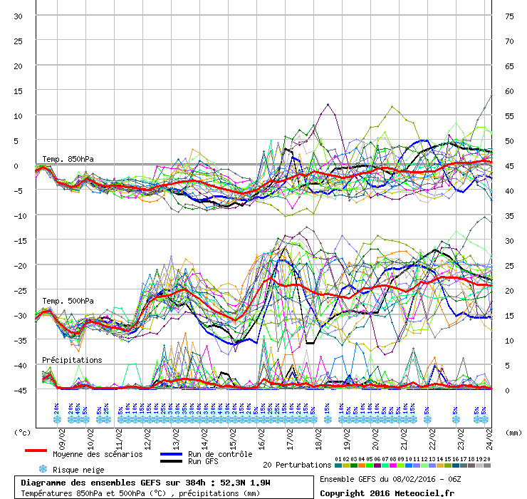
http://www.meteociel.fr/modeles/ecmwf.php?ech=0&mode=0&map=3&type=0&archive=0
I think that's one of the milder ensembles showing in that chart?


 )
)


Model Output Discussions 18z 31/01/2016
in Forecast Model Discussion
Posted · Edited by wishingforsnow
Could be another solution I suppose
With ECM the North would get snow and the South freezing rain this weekend
But ECM shows us cold at 240 with the mid Atlantic block reasserting itself.
GFS at the same time frame has high pressure over us, drier but milder.
Hopefully FI is showing the signs of the end of these stormy wet 4 months, in any case drier weather is welcome, cold or mild.
Though Met have not specifically mentioned any cold or snow for the next week (yet) they have consistently gone for a more settled outcome present from the end of February into March.